Steinbrunn geodata
Steinbrunn (Burgenland) is a seat of a third-order administrative division; located in Austria in Europe/Vienna (GMT+2) time zone. With population of 2,614 people, there are 453 cities with bigger population in this country. Compared to other cities in Austria, 58.1% of cities are located further ↓South; 91.7% of cities are located further ←West and 90.4% of cities have higher elevation than Steinbrunn. Note1


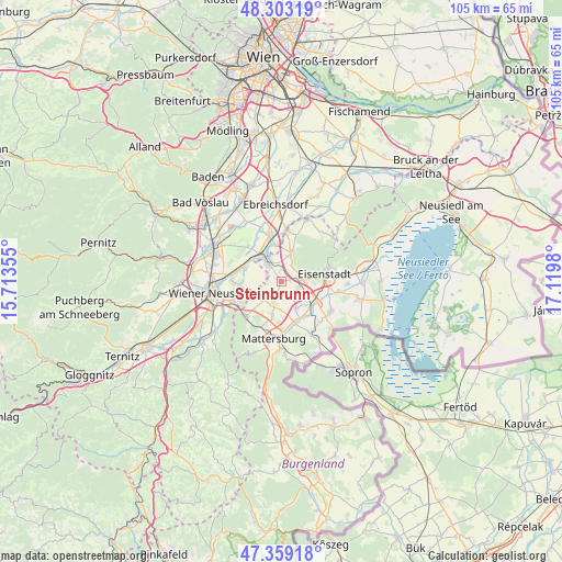
Steinbrunn GPS coordinates[2]
47° 49' 59.988" North, 16° 25' 0.012" East
| Map corner | latitude | longitude |
|---|---|---|
| Upper-left | 48.30319°, | 15.71355° |
| Center: | 47.83333°, | 16.41667° |
| Lower-right: | 47.35918°, | 17.1198° |
| Map W x H: | 105×105 km | = 65.2×65.2mi |
| max Lat: | 48.98333° ⇑41.9% North |
| Steinbrunn: | 47.83333° |
| min Lat: | ⇓58.1% South 46.48841° |
| min Long | Steinbrunn | max Long |
| 9.57802° | 16.41667° | 17.1° |
| W 91.7%⇐ | ⇒8.3% E |
Elevation
Elevation of Steinbrunn is 211 m = 692 ft, and this is 294.5 m = 966 ft below average elevation for this country.
| Max E: |
2140 m = 7021 ft | 90.4% |
| Avg. | 505.5 m = 1658 ft | |
| Steinbrunn | 211 m = 692 ft | |
Min E: |
118 m = 387 ft | 9.6% |
See also: Austria elevation on elevation.city.
Geographical zone
Steinbrunn is located in North temperate zone (between Tropic of Cancer and the Arctic Circle). Distance of this North polar circle is 2082.6 km =1294.1 mi to North.| Distance of | km | miles | from Steinbrunn |
|---|---|---|---|
| North Pole | 4688.5 | 2913.3 | to North |
| Arctic Circle | 2082.6 | 1294.1 | to North |
| Tropic Cancer | 2712.6 | 1685.5 | to South |
| Equator | 5318.6 | 3304.8 | to South |


Nearby cities:
15 places around Steinbrunn: (largest is in red/bold)
• Ebenfurth
6.1 km =3.8 mi,  323°
323°
• Eggendorf
7.6 km =4.7 mi,  291°
291°
• Grosshöflein
4.8 km =3 mi,  86°
86°
• Hirm
5.9 km =3.7 mi,  151°
151°
• Hornstein
5.6 km =3.5 mi,  21°
21°
• Kleinhöflein im Burgenland
6.6 km =4.1 mi,  82°
82°
• Krensdorf
5.3 km =3.3 mi,  181°
181°
• Landegg
7.5 km =4.7 mi,  350°
350°
• Müllendorf
3.5 km =2.2 mi, 78°
• Neufeld an der Leitha
4.6 km =2.9 mi, 321°
• Pöttsching
4.7 km =2.9 mi,  226°
226°
• Sigless
6.6 km =4.1 mi,  194°
194°
• Zillingdorf
6.5 km =4 mi, 286°
• Zillingdorf-Bergwerk
2.9 km =1.8 mi, 293°
• Zillingtal
2.2 km =1.4 mi, 194°
Sources, notices
• [Note1] Compared only with cities in Austria existing in our database
• [Src1] Map data: © OpenStreetMap contributors (CC-BY-SA)
• [Src2] Other city data from geonames.org with taken over terms of usage.
• [Src3] Geographical zone / Annual Mean Temperature by Robert A. Rohde @ Wikipedia
