Gurgl geodata
Gurgl (Tyrol) is a populated place; located in Austria in Europe/Vienna (GMT+2) time zone. With population of 521 people, there are 2427 cities with bigger population in this country. Compared to other cities in Austria, 88.6% of cities are located further ↑North; 93.5% of cities are located further →East and 100% of cities have lower elevation than Gurgl. Note1


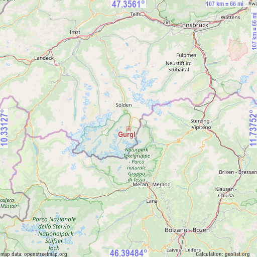
Gurgl GPS coordinates[2]
46° 52' 39.432" North, 11° 2' 3.804" East
| Map corner | latitude | longitude |
|---|---|---|
| Upper-left | 47.3561°, | 10.33127° |
| Center: | 46.87762°, | 11.03439° |
| Lower-right: | 46.39484°, | 11.73752° |
| Map W x H: | 106.9×106.9 km | = 66.4×66.4mi |
| max Lat: | 48.98333° ⇑88.6% North |
| Gurgl: | 46.87762° |
| min Lat: | ⇓11.4% South 46.48841° |
| min Long | Gurgl | max Long |
| 9.57802° | 11.03439° | 17.1° |
| W 6.5%⇐ | ⇒93.5% E |
Elevation
Elevation of Gurgl is 1887 m = 6191 ft, and this is 1381.5 m = 4532 ft above average elevation for this country.
| Max E: |
2140 m = 7021 ft | 0% |
| Gurgl | 1887 m 6191 ft | |
| Avg. | 505.5 m = 1658 ft | |
Min E: |
118 m = 387 ft | 100% |
See also: Austria elevation on elevation.city.
Geographical zone
Gurgl is located in North temperate zone (between Tropic of Cancer and the Arctic Circle). Distance of this North polar circle is 2188.9 km =1360.1 mi to North.| Distance of | km | miles | from Gurgl |
|---|---|---|---|
| North Pole | 4794.8 | 2979.3 | to North |
| Arctic Circle | 2188.9 | 1360.1 | to North |
| Tropic Cancer | 2606.4 | 1619.5 | to South |
| Equator | 5212.3 | 3238.8 | to South |


Nearby cities:
15 places around Gurgl: (largest is in red/bold)
• Fendels
33.4 km =20.8 mi,  305°
305°
• Gries im Sellrain
36.5 km =22.7 mi,  14°
14°
• Gschnitz
30.4 km =18.9 mi,  52°
52°
• Kaunertal
27.7 km =17.2 mi, 307°
• Kauns
34.2 km =21.3 mi, 310°
• Längenfeld
22.4 km =13.9 mi,  347°
347°
• Neustift im Stubaital
34.1 km =21.2 mi,  38°
38°
• Obernberg am Brenner
32.9 km =20.4 mi,  61°
61°
• Prutz
36.1 km =22.4 mi, 309°
• Ried im Oberinntal
34.9 km =21.7 mi,  303°
303°
• Sankt Leonhard im Pitztal
25.3 km =15.7 mi,  326°
326°
• Sölden
10.2 km =6.3 mi, 345°
• Tumpen
33.7 km =20.9 mi,  342°
342°
• Tösens
36 km =22.4 mi, 295°
• Umhausen
29.7 km =18.5 mi, 344°
Sources, notices
• [Note1] Compared only with cities in Austria existing in our database
• [Src1] Map data: © OpenStreetMap contributors (CC-BY-SA)
• [Src2] Other city data from geonames.org with taken over terms of usage.
• [Src3] Geographical zone / Annual Mean Temperature by Robert A. Rohde @ Wikipedia
