Leutschach geodata
Leutschach (Styria) is a seat of a third-order administrative division; located in Austria in Europe/Vienna (GMT+2) time zone. With population of 557 people, there are 2289 cities with bigger population in this country. Compared to other cities in Austria, 96.2% of cities are located further ↑North; 64.6% of cities are located further ←West and 65.7% of cities have higher elevation than Leutschach. Note1
Administrative division(s):
- Level 1: Styria
- Level 2: Politischer Bezirk Leibnitz
- Level 3: Leutschach an der Weinstraße


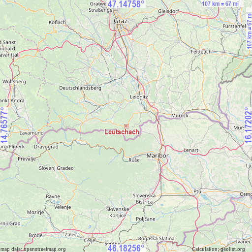
Leutschach GPS coordinates[2]
46° 40' 1.992" North, 15° 28' 8.004" East
| Map corner | latitude | longitude |
|---|---|---|
| Upper-left | 47.14758°, | 14.76577° |
| Center: | 46.66722°, | 15.46889° |
| Lower-right: | 46.18256°, | 16.17202° |
| Map W x H: | 107.3×107.3 km | = 66.7×66.7mi |
| max Lat: | 48.98333° ⇑96.2% North |
| Leutschach: | 46.66722° |
| min Lat: | ⇓3.8% South 46.48841° |
| min Long | Leutschach | max Long |
| 9.57802° | 15.46889° | 17.1° |
| W 64.6%⇐ | ⇒35.4% E |
Elevation
Elevation of Leutschach is 351 m = 1152 ft, and this is 154.5 m = 507 ft below average elevation for this country.
| Max E: |
2140 m = 7021 ft | 65.7% |
| Avg. | 505.5 m = 1658 ft | |
| Leutschach | 351 m = 1152 ft | |
Min E: |
118 m = 387 ft | 34.3% |
See also: Austria elevation on elevation.city.
Geographical zone
Leutschach is located in North temperate zone (between Tropic of Cancer and the Arctic Circle). Distance of this North polar circle is 2212.3 km =1374.7 mi to North.| Distance of | km | miles | from Leutschach |
|---|---|---|---|
| North Pole | 4818.2 | 2993.9 | to North |
| Arctic Circle | 2212.3 | 1374.7 | to North |
| Tropic Cancer | 2583 | 1605 | to South |
| Equator | 5188.9 | 3224.2 | to South |


Nearby cities:
15 places around Leutschach: (largest is in red/bold)
• Arnfels
5.1 km =3.2 mi,  281°
281°
• Ehrenhausen
11 km =6.8 mi,  54°
54°
• Eichberg-Trautenburg
3 km =1.9 mi,  337°
337°
• Fötschach
2.1 km =1.3 mi,  31°
31°
• Gamlitz
8.7 km =5.4 mi, 47°
• Großklein
7.9 km =4.9 mi,  346°
346°
• Heimschuh
10.5 km =6.5 mi,  10°
10°
• Oberhaag
10.7 km =6.6 mi, 281°
• Ratsch an der Weinstraße
8.2 km =5.1 mi,  72°
72°
• Retznei
10.5 km =6.5 mi, 45°
• Sankt Johann im Saggautal
6.5 km =4 mi,  308°
308°
• Schlossberg
2.2 km =1.4 mi,  150°
150°
• Seggauberg
11.6 km =7.2 mi,  18°
18°
• Sulztal an der Weinstraße
6.4 km =4 mi, 73°
• Untergreith
10.6 km =6.6 mi,  301°
301°
Sources, notices
• [Note1] Compared only with cities in Austria existing in our database
• [Src1] Map data: © OpenStreetMap contributors (CC-BY-SA)
• [Src2] Other city data from geonames.org with taken over terms of usage.
• [Src3] Geographical zone / Annual Mean Temperature by Robert A. Rohde @ Wikipedia
