Fötschach geodata
Fötschach (Styria) is a populated place; located in Austria in Europe/Vienna (GMT+2) time zone. With population of 610 people, there are 2104 cities with bigger population in this country. Compared to other cities in Austria, 95.9% of cities are located further ↑North; 64.9% of cities are located further ←West and 54.3% of cities have higher elevation than Fötschach. Note1
Administrative division(s):
- Level 1: Styria
- Level 2: Politischer Bezirk Leibnitz
- Level 3: Leutschach an der Weinstraße


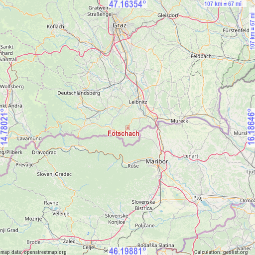
Fötschach GPS coordinates[2]
46° 40' 59.988" North, 15° 28' 59.988" East
| Map corner | latitude | longitude |
|---|---|---|
| Upper-left | 47.16354°, | 14.78021° |
| Center: | 46.68333°, | 15.48333° |
| Lower-right: | 46.19881°, | 16.18646° |
| Map W x H: | 107.3×107.3 km | = 66.7×66.7mi |
| max Lat: | 48.98333° ⇑95.9% North |
| Fötschach: | 46.68333° |
| min Lat: | ⇓4.1% South 46.48841° |
| min Long | Fötschach | max Long |
| 9.57802° | 15.48333° | 17.1° |
| W 64.9%⇐ | ⇒35.1% E |
Elevation
Elevation of Fötschach is 425 m = 1394 ft, and this is 80.5 m = 264 ft below average elevation for this country.
| Max E: |
2140 m = 7021 ft | 54.3% |
| Avg. | 505.5 m = 1658 ft | |
| Fötschach | 425 m = 1394 ft | |
Min E: |
118 m = 387 ft | 45.7% |
See also: Austria elevation on elevation.city.
Geographical zone
Fötschach is located in North temperate zone (between Tropic of Cancer and the Arctic Circle). Distance of this North polar circle is 2210.5 km =1373.5 mi to North.| Distance of | km | miles | from Fötschach |
|---|---|---|---|
| North Pole | 4816.4 | 2992.8 | to North |
| Arctic Circle | 2210.5 | 1373.5 | to North |
| Tropic Cancer | 2584.8 | 1606.1 | to South |
| Equator | 5190.7 | 3225.4 | to South |


Nearby cities:
15 places around Fötschach: (largest is in red/bold)
• Arnfels
6.2 km =3.9 mi,  262°
262°
• Ehrenhausen
9.1 km =5.7 mi,  60°
60°
• Eichberg-Trautenburg
2.5 km =1.6 mi,  293°
293°
• Gamlitz
6.7 km =4.2 mi,  52°
52°
• Großklein
6.6 km =4.1 mi,  333°
333°
• Heimschuh
8.6 km =5.3 mi,  4°
4°
• Leutschach
2.1 km =1.3 mi,  211°
211°
• Obervogau
10.3 km =6.4 mi, 48°
• Ratsch an der Weinstraße
6.7 km =4.2 mi,  84°
84°
• Retznei
8.4 km =5.2 mi, 48°
• Sankt Johann im Saggautal
6.6 km =4.1 mi, 290°
• Schlossberg
3.7 km =2.3 mi,  180°
180°
• Seggauberg
9.6 km =6 mi,  15°
15°
• Sulztal an der Weinstraße
5.1 km =3.2 mi,  90°
90°
• Untergreith
10.8 km =6.7 mi, 290°
Sources, notices
• [Note1] Compared only with cities in Austria existing in our database
• [Src1] Map data: © OpenStreetMap contributors (CC-BY-SA)
• [Src2] Other city data from geonames.org with taken over terms of usage.
• [Src3] Geographical zone / Annual Mean Temperature by Robert A. Rohde @ Wikipedia
