Stansbury geodata
Stansbury (South Australia) is a populated place; located in Australia in Australia/Adelaide (GMT+10.5) time zone. With population of 640 people, there are 4472 cities with bigger population in this country. Compared to other cities in Australia, 68.6% of cities are located further ↑North; 85.5% of cities are located further →East and 96.8% of cities have higher elevation than Stansbury. Note1


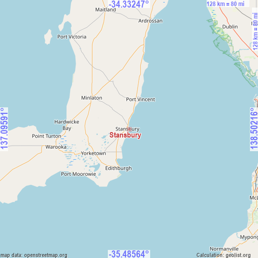
Stansbury GPS coordinates[2]
34° 54' 39.888" South, 137° 47' 56.508" East
| Map corner | latitude | longitude |
|---|---|---|
| Upper-left | -34.33247°, | 137.09591° |
| Center: | -34.91108°, | 137.79903° |
| Lower-right: | -35.48564°, | 138.50216° |
| Map W x H: | 128.2×128.2 km | = 79.7×79.7mi |
| max Lat: | -10.58257° ⇑68.6% North |
| Stansbury: | -34.91108° |
| min Lat: | ⇓31.4% South -43.31423° |
| min Long | Stansbury | max Long |
| 113.53327° | 137.79903° | 153.61246° |
| W 14.5%⇐ | ⇒85.5% E |
Elevation
Elevation of Stansbury is 5 m = 16 ft, and this is 117 m = 384 ft below average elevation for this country.
| Max E: |
1715 m = 5627 ft | 96.8% |
| Avg. | 122 m = 400 ft | |
| Stansbury | 5 m = 16 ft | |
Min E: |
-2 m = -7 ft | 3.2% |
See also: Australia elevation on elevation.city.
Geographical zone
Stansbury is located in South temperate zone (between Tropic of Capricorn and the Antarctic Circle). Distance of this Southern Tropic circle is 1275.8 km =792.7 mi to North.| Distance of | km | miles | from Stansbury |
|---|---|---|---|
| Equator | 3881.7 | 2412 | to North |
| Tropic Capricorn | 1275.8 | 792.7 | to North |
| Antarctic Circle | 3519.4 | 2186.9 | to South |
| South Pole | 6125.3 | 3806.1 | to South |


Nearby cities:
15 places around Stansbury: (largest is in red/bold)
• Ardrossan
55.5 km =34.5 mi,  11°
11°
• Ethelton
63.5 km =39.5 mi,  83°
83°
• Exeter
63.4 km =39.4 mi, 82°
• Grange
63 km =39.1 mi,  89°
89°
• Henley Beach
63.4 km =39.4 mi, 90°
• Honiton
26.6 km =16.5 mi,  210°
210°
• Largs Bay
63.4 km =39.4 mi, 81°
• Maitland
60.8 km =37.8 mi,  349°
349°
• Minlaton
24.2 km =15 mi,  310°
310°
• Semaphore
62.8 km =39 mi, 82°
• Semaphore Park
62.4 km =38.8 mi, 83°
• Semaphore South
62.4 km =38.8 mi, 83°
• Tennyson
62.7 km =39 mi, 87°
• West Lakes Shore
63.2 km =39.3 mi, 84°
• Yorketown
21.3 km =13.2 mi,  235°
235°
Sources, notices
• [Note1] Compared only with cities in Australia existing in our database
• [Src1] Map data: © OpenStreetMap contributors (CC-BY-SA)
• [Src2] Other city data from geonames.org with taken over terms of usage.
• [Src3] Geographical zone / Annual Mean Temperature by Robert A. Rohde @ Wikipedia
