Birdwood geodata
Birdwood (South Australia) is a populated place; located in Australia in Australia/Adelaide (GMT+10.5) time zone. With population of 1,290 people, there are 3483 cities with bigger population in this country. Compared to other cities in Australia, 66% of cities are located further ↑North; 76.8% of cities are located further →East and 90.4% of cities have lower elevation than Birdwood. Note1


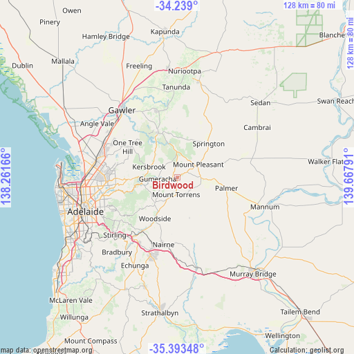
Birdwood GPS coordinates[2]
34° 49' 5.736" South, 138° 57' 53.208" East
| Map corner | latitude | longitude |
|---|---|---|
| Upper-left | -34.239°, | 138.26166° |
| Center: | -34.81826°, | 138.96478° |
| Lower-right: | -35.39348°, | 139.66791° |
| Map W x H: | 128.4×128.4 km | = 79.8×79.8mi |
| max Lat: | -10.58257° ⇑66% North |
| Birdwood: | -34.81826° |
| min Lat: | ⇓34% South -43.31423° |
| min Long | Birdwood | max Long |
| 113.53327° | 138.96478° | 153.61246° |
| W 23.2%⇐ | ⇒76.8% E |
Elevation
Elevation of Birdwood is 390 m = 1280 ft, and this is 268 m = 879 ft above average elevation for this country.
| Max E: |
1715 m = 5627 ft | 9.6% |
| Birdwood | 390 m 1280 ft | |
| Avg. | 122 m = 400 ft | |
Min E: |
-2 m = -7 ft | 90.4% |
See also: Australia elevation on elevation.city.
Geographical zone
Birdwood is located in South temperate zone (between Tropic of Capricorn and the Antarctic Circle). Distance of this Southern Tropic circle is 1265.5 km =786.3 mi to North.| Distance of | km | miles | from Birdwood |
|---|---|---|---|
| Equator | 3871.4 | 2405.6 | to North |
| Tropic Capricorn | 1265.5 | 786.3 | to North |
| Antarctic Circle | 3529.7 | 2193.3 | to South |
| South Pole | 6135.6 | 3812.5 | to South |


Nearby cities:
15 places around Birdwood: (largest is in red/bold)
• Banksia Park
20.9 km =13 mi,  272°
272°
• Charleston
12.4 km =7.7 mi,  208°
208°
• Fairview Park
21.7 km =13.5 mi,  275°
275°
• Golden Grove
21.5 km =13.4 mi, 280°
• Gumeracha
7.3 km =4.5 mi, 265°
• Kersbrook
11.1 km =6.9 mi,  290°
290°
• Lobethal
12.6 km =7.8 mi,  220°
220°
• Mount Pleasant
9.1 km =5.7 mi,  57°
57°
• Mount Torrens
6.4 km =4 mi,  185°
185°
• Oakbank
21.4 km =13.3 mi, 210°
• Springton
16.8 km =10.4 mi,  42°
42°
• Tea Tree Gully
21.1 km =13.1 mi, 270°
• Vista
22.1 km =13.7 mi, 265°
• Williamstown
17.6 km =10.9 mi,  337°
337°
• Woodside
17 km =10.6 mi, 207°
Sources, notices
• [Note1] Compared only with cities in Australia existing in our database
• [Src1] Map data: © OpenStreetMap contributors (CC-BY-SA)
• [Src2] Other city data from geonames.org with taken over terms of usage.
• [Src3] Geographical zone / Annual Mean Temperature by Robert A. Rohde @ Wikipedia
