Wingello geodata
Wingello (New South Wales) is a populated place; located in Australia in Australia/Sydney (GMT+11) time zone. With population of 553 people, there are 4694 cities with bigger population in this country. Compared to other cities in Australia, 64.7% of cities are located further ↑North; 57.4% of cities are located further ←West and 98.2% of cities have lower elevation than Wingello. Note1


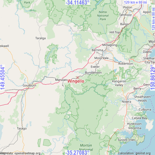
Wingello GPS coordinates[2]
34° 41' 41.1" South, 150° 9' 29.376" East
| Map corner | latitude | longitude |
|---|---|---|
| Upper-left | -34.11463°, | 149.45504° |
| Center: | -34.69475°, | 150.15816° |
| Lower-right: | -35.27083°, | 150.86129° |
| Map W x H: | 128.6×128.6 km | = 79.9×79.9mi |
| max Lat: | -10.58257° ⇑64.7% North |
| Wingello: | -34.69475° |
| min Lat: | ⇓35.3% South -43.31423° |
| min Long | Wingello | max Long |
| 113.53327° | 150.15816° | 153.61246° |
| W 57.4%⇐ | ⇒42.6% E |
Elevation
Elevation of Wingello is 685 m = 2247 ft, and this is 563 m = 1847 ft above average elevation for this country.
| Max E: |
1715 m = 5627 ft | 1.8% |
| Wingello | 685 m 2247 ft | |
| Avg. | 122 m = 400 ft | |
Min E: |
-2 m = -7 ft | 98.2% |
See also: Australia elevation on elevation.city.
Geographical zone
Wingello is located in South temperate zone (between Tropic of Capricorn and the Antarctic Circle). Distance of this Southern Tropic circle is 1251.8 km =777.8 mi to North.| Distance of | km | miles | from Wingello |
|---|---|---|---|
| Equator | 3857.7 | 2397.1 | to North |
| Tropic Capricorn | 1251.8 | 777.8 | to North |
| Antarctic Circle | 3543.5 | 2201.8 | to South |
| South Pole | 6149.4 | 3821.1 | to South |


Nearby cities:
15 places around Wingello: (largest is in red/bold)
• Berrima
28.4 km =17.6 mi,  35°
35°
• Bowral
34.1 km =21.2 mi, 44°
• Bundanoon
13.3 km =8.3 mi,  71°
71°
• Burradoo
31.3 km =19.4 mi,  47°
47°
• Cambewarra Village
39.3 km =24.4 mi,  111°
111°
• Exeter
17.4 km =10.8 mi,  58°
58°
• Kangaroo Valley
34.9 km =21.7 mi,  97°
97°
• Marulan
13.7 km =8.5 mi,  263°
263°
• Mittagong
37.9 km =23.5 mi, 44°
• Moss Vale
25 km =15.5 mi, 51°
• New Berrima
26.7 km =16.6 mi, 37°
• Renwick
39.6 km =24.6 mi, 46°
• Tallong
7.3 km =4.5 mi,  250°
250°
• Tapitallee
37.9 km =23.5 mi, 113°
• Welby
37.8 km =23.5 mi, 41°
Sources, notices
• [Note1] Compared only with cities in Australia existing in our database
• [Src1] Map data: © OpenStreetMap contributors (CC-BY-SA)
• [Src2] Other city data from geonames.org with taken over terms of usage.
• [Src3] Geographical zone / Annual Mean Temperature by Robert A. Rohde @ Wikipedia
