Tallong geodata
Tallong (New South Wales) is a populated place; located in Australia in Australia/Sydney (GMT+11) time zone. With population of 804 people, there are 4138 cities with bigger population in this country. Compared to other cities in Australia, 65% of cities are located further ↑North; 57.1% of cities are located further ←West and 96.3% of cities have lower elevation than Tallong. Note1


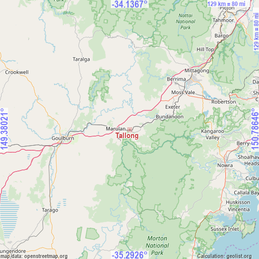
Tallong GPS coordinates[2]
34° 43' 0.012" South, 150° 4' 59.988" East
| Map corner | latitude | longitude |
|---|---|---|
| Upper-left | -34.1367°, | 149.38021° |
| Center: | -34.71667°, | 150.08333° |
| Lower-right: | -35.2926°, | 150.78646° |
| Map W x H: | 128.5×128.5 km | = 79.8×79.8mi |
| max Lat: | -10.58257° ⇑65% North |
| Tallong: | -34.71667° |
| min Lat: | ⇓35% South -43.31423° |
| min Long | Tallong | max Long |
| 113.53327° | 150.08333° | 153.61246° |
| W 57.1%⇐ | ⇒42.9% E |
Elevation
Elevation of Tallong is 612 m = 2008 ft, and this is 490 m = 1608 ft above average elevation for this country.
| Max E: |
1715 m = 5627 ft | 3.7% |
| Tallong | 612 m 2008 ft | |
| Avg. | 122 m = 400 ft | |
Min E: |
-2 m = -7 ft | 96.3% |
See also: Australia elevation on elevation.city.
Geographical zone
Tallong is located in South temperate zone (between Tropic of Capricorn and the Antarctic Circle). Distance of this Southern Tropic circle is 1254.2 km =779.3 mi to North.| Distance of | km | miles | from Tallong |
|---|---|---|---|
| Equator | 3860.1 | 2398.6 | to North |
| Tropic Capricorn | 1254.2 | 779.3 | to North |
| Antarctic Circle | 3541 | 2200.3 | to South |
| South Pole | 6146.9 | 3819.5 | to South |


Nearby cities:
15 places around Tallong: (largest is in red/bold)
• Berrima
34.6 km =21.5 mi,  42°
42°
• Bowral
40.7 km =25.3 mi,  49°
49°
• Bundanoon
20.6 km =12.8 mi,  71°
71°
• Burradoo
38.1 km =23.7 mi, 51°
• Cambewarra Village
45.1 km =28 mi,  105°
105°
• Exeter
24.6 km =15.3 mi,  62°
62°
• Goulburn
33.3 km =20.7 mi,  263°
263°
• Kangaroo Valley
41.5 km =25.8 mi,  93°
93°
• Marulan
6.8 km =4.2 mi,  277°
277°
• Mittagong
44.5 km =27.7 mi, 48°
• Moss Vale
32 km =19.9 mi, 55°
• New Berrima
33 km =20.5 mi, 44°
• Tapitallee
43.5 km =27 mi, 106°
• Welby
44.3 km =27.5 mi, 45°
• Wingello
7.3 km =4.5 mi, 70°
Sources, notices
• [Note1] Compared only with cities in Australia existing in our database
• [Src1] Map data: © OpenStreetMap contributors (CC-BY-SA)
• [Src2] Other city data from geonames.org with taken over terms of usage.
• [Src3] Geographical zone / Annual Mean Temperature by Robert A. Rohde @ Wikipedia
