Cambewarra Village geodata
Cambewarra Village (New South Wales) is a populated place; located in Australia in Australia/Sydney (GMT+11) time zone. With population of 1,155 people, there are 3634 cities with bigger population in this country. Compared to other cities in Australia, 66.1% of cities are located further ↑North; 59.2% of cities are located further ←West and 64.4% of cities have lower elevation than Cambewarra Village. Note1


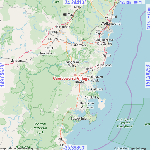
Cambewarra Village GPS coordinates[2]
34° 49' 24.06" South, 150° 33' 33.84" East
| Map corner | latitude | longitude |
|---|---|---|
| Upper-left | -34.24413°, | 149.85628° |
| Center: | -34.82335°, | 150.5594° |
| Lower-right: | -35.39853°, | 151.26253° |
| Map W x H: | 128.4×128.4 km | = 79.8×79.8mi |
| max Lat: | -10.58257° ⇑66.1% North |
| Cambewarra Village: | -34.82335° |
| min Lat: | ⇓33.9% South -43.31423° |
| min Long | Cambewarra Vill | max Long |
| 113.53327° | 150.5594° | 153.61246° |
| W 59.2%⇐ | ⇒40.8% E |
Elevation
Elevation of Cambewarra Village is 78 m = 256 ft, and this is 44 m = 144 ft below average elevation for this country.
| Max E: |
1715 m = 5627 ft | 35.6% |
| Avg. | 122 m = 400 ft | |
| Cambewarra Village | 78 m = 256 ft | |
Min E: |
-2 m = -7 ft | 64.4% |
See also: Australia elevation on elevation.city.
Geographical zone
Cambewarra Village is located in South temperate zone (between Tropic of Capricorn and the Antarctic Circle). Distance of this Southern Tropic circle is 1266.1 km =786.7 mi to North.| Distance of | km | miles | from Cambewarra Village |
|---|---|---|---|
| Equator | 3872 | 2405.9 | to North |
| Tropic Capricorn | 1266.1 | 786.7 | to North |
| Antarctic Circle | 3529.2 | 2192.9 | to South |
| South Pole | 6135.1 | 3812.2 | to South |


Nearby cities:
15 places around Cambewarra Village: (largest is in red/bold)
• Berry
13.4 km =8.3 mi,  66°
66°
• Bomaderry
5.5 km =3.4 mi,  121°
121°
• Culburra Beach
21.5 km =13.4 mi, 122°
• Falls Creek
16.4 km =10.2 mi,  166°
166°
• Greenwell Point
18.2 km =11.3 mi, 120°
• Kangaroo Valley
9.7 km =6 mi,  347°
347°
• North Nowra
4.1 km =2.5 mi,  160°
160°
• Nowra
7.7 km =4.8 mi,  151°
151°
• Nowra Hill
11.7 km =7.3 mi, 174°
• Orient Point
19.8 km =12.3 mi, 118°
• Shoalhaven Heads
17.2 km =10.7 mi,  100°
100°
• South Nowra
9.6 km =6 mi, 158°
• Tapitallee
1.9 km =1.2 mi,  248°
248°
• West Nowra
7.3 km =4.5 mi, 162°
• Worrigee
10.9 km =6.8 mi,  141°
141°
Sources, notices
• [Note1] Compared only with cities in Australia existing in our database
• [Src1] Map data: © OpenStreetMap contributors (CC-BY-SA)
• [Src2] Other city data from geonames.org with taken over terms of usage.
• [Src3] Geographical zone / Annual Mean Temperature by Robert A. Rohde @ Wikipedia
