Murrurundi geodata
Murrurundi (New South Wales) is a populated place; located in Australia in Australia/Sydney (GMT+11) time zone. With population of 1,031 people, there are 3781 cities with bigger population in this country. Compared to other cities in Australia, 68.5% of cities are located further ↓South; 63.4% of cities are located further ←West and 92.9% of cities have lower elevation than Murrurundi. Note1


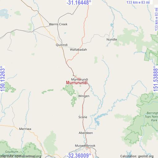
Murrurundi GPS coordinates[2]
31° 45' 51.192" South, 150° 50' 8.7" East
| Map corner | latitude | longitude |
|---|---|---|
| Upper-left | -31.16448°, | 150.13263° |
| Center: | -31.76422°, | 150.83575° |
| Lower-right: | -32.36009°, | 151.53888° |
| Map W x H: | 132.9×132.9 km | = 82.6×82.6mi |
| max Lat: | -10.58257° ⇑31.5% North |
| Murrurundi: | -31.76422° |
| min Lat: | ⇓68.5% South -43.31423° |
| min Long | Murrurundi | max Long |
| 113.53327° | 150.83575° | 153.61246° |
| W 63.4%⇐ | ⇒36.6% E |
Elevation
Elevation of Murrurundi is 469 m = 1539 ft, and this is 347 m = 1138 ft above average elevation for this country.
| Max E: |
1715 m = 5627 ft | 7.1% |
| Murrurundi | 469 m 1539 ft | |
| Avg. | 122 m = 400 ft | |
Min E: |
-2 m = -7 ft | 92.9% |
See also: Australia elevation on elevation.city.
Geographical zone
Murrurundi is located in South temperate zone (between Tropic of Capricorn and the Antarctic Circle). Distance of this Southern Tropic circle is 925.9 km =575.3 mi to North.| Distance of | km | miles | from Murrurundi |
|---|---|---|---|
| Equator | 3531.9 | 2194.6 | to North |
| Tropic Capricorn | 925.9 | 575.3 | to North |
| Antarctic Circle | 3869.3 | 2404.3 | to South |
| South Pole | 6475.2 | 4023.5 | to South |


Nearby cities:
15 places around Murrurundi: (largest is in red/bold)
• Aberdeen
45 km =28 mi,  173°
173°
• Calala
67.1 km =41.7 mi,  11°
11°
• Denman
70.7 km =43.9 mi,  191°
191°
• Duri
61.2 km =38 mi,  358°
358°
• Hillvue
71.1 km =44.2 mi, 5°
• Loomberah
56.3 km =35 mi,  17°
17°
• Merriwa
61.6 km =38.3 mi,  227°
227°
• Muswellbrook
55.5 km =34.5 mi, 174°
• Nemingha
72.7 km =45.2 mi, 11°
• Nundle
43.2 km =26.8 mi,  39°
39°
• Phillip
70.2 km =43.6 mi,  1°
1°
• Quirindi
32.2 km =20 mi,  332°
332°
• Scone
31.9 km =19.8 mi, 174°
• South Tamworth
73.2 km =45.5 mi, 6°
• Werris Creek
49.4 km =30.7 mi,  338°
338°
Sources, notices
• [Note1] Compared only with cities in Australia existing in our database
• [Src1] Map data: © OpenStreetMap contributors (CC-BY-SA)
• [Src2] Other city data from geonames.org with taken over terms of usage.
• [Src3] Geographical zone / Annual Mean Temperature by Robert A. Rohde @ Wikipedia
