Maudsland geodata
Maudsland (Queensland) is a section of populated place; located in Australia in Australia/Brisbane (GMT+10) time zone. With population of 5,468 people, there are 1355 cities with bigger population in this country. Compared to other cities in Australia, 76.4% of cities are located further ↓South; 97.4% of cities are located further ←West and 69.8% of cities have higher elevation than Maudsland. Note1


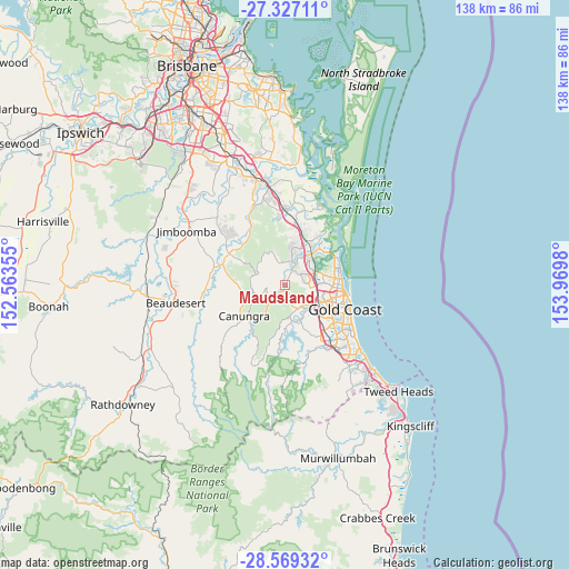
Maudsland GPS coordinates[2]
27° 57' 0" South, 153° 16' 0.012" East
| Map corner | latitude | longitude |
|---|---|---|
| Upper-left | -27.32711°, | 152.56355° |
| Center: | -27.95°, | 153.26667° |
| Lower-right: | -28.56932°, | 153.9698° |
| Map W x H: | 138.1×138.1 km | = 85.8×85.8mi |
| max Lat: | -10.58257° ⇑23.6% North |
| Maudsland: | -27.95° |
| min Lat: | ⇓76.4% South -43.31423° |
| min Long | Maudsland | max Long |
| 113.53327° | 153.26667° | 153.61246° |
| W 97.4%⇐ | ⇒2.6% E |
Elevation
Elevation of Maudsland is 23 m = 75 ft, and this is 99 m = 325 ft below average elevation for this country.
| Max E: |
1715 m = 5627 ft | 69.8% |
| Avg. | 122 m = 400 ft | |
| Maudsland | 23 m = 75 ft | |
Min E: |
-2 m = -7 ft | 30.2% |
See also: Australia elevation on elevation.city.
Geographical zone
Maudsland is located in South temperate zone (between Tropic of Capricorn and the Antarctic Circle). Distance of this Southern Tropic circle is 501.8 km =311.8 mi to North.| Distance of | km | miles | from Maudsland |
|---|---|---|---|
| Equator | 3107.7 | 1931 | to North |
| Tropic Capricorn | 501.8 | 311.8 | to North |
| Antarctic Circle | 4293.4 | 2667.8 | to South |
| South Pole | 6899.3 | 4287 | to South |


Nearby cities:
15 places around Maudsland: (largest is in red/bold)
• Arundel
9.6 km =6 mi,  81°
81°
• Clagiraba
5.4 km =3.4 mi,  206°
206°
• Gaven
6.7 km =4.2 mi,  96°
96°
• Guanaba
3 km =1.9 mi,  296°
296°
• Helensvale
7.4 km =4.6 mi,  61°
61°
• Highland Park
9.6 km =6 mi,  137°
137°
• Molendinar
9.6 km =6 mi,  106°
106°
• Mount Nathan
1.7 km =1.1 mi,  161°
161°
• Nerang
8.1 km =5 mi,  122°
122°
• Oxenford
8.1 km =5 mi,  34°
34°
• Pacific Pines
4.8 km =3 mi, 76°
• Parkwood
9.5 km =5.9 mi,  93°
93°
• Tamborine Mountain
7 km =4.3 mi,  251°
251°
• Upper Coomera
8.3 km =5.2 mi,  12°
12°
• Wongawallan
9.1 km =5.7 mi,  335°
335°
Sources, notices
• [Note1] Compared only with cities in Australia existing in our database
• [Src1] Map data: © OpenStreetMap contributors (CC-BY-SA)
• [Src2] Other city data from geonames.org with taken over terms of usage.
• [Src3] Geographical zone / Annual Mean Temperature by Robert A. Rohde @ Wikipedia
