Guanaba geodata
Guanaba (Queensland) is a section of populated place; located in Australia in Australia/Brisbane (GMT+10) time zone. With population of 779 people, there are 4189 cities with bigger population in this country. Compared to other cities in Australia, 76.5% of cities are located further ↓South; 97.1% of cities are located further ←West and 52% of cities have lower elevation than Guanaba. Note1


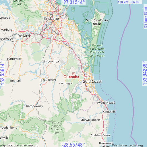
Guanaba GPS coordinates[2]
27° 56' 17.16" South, 153° 14' 21.336" East
| Map corner | latitude | longitude |
|---|---|---|
| Upper-left | -27.31514°, | 152.53614° |
| Center: | -27.9381°, | 153.23926° |
| Lower-right: | -28.55748°, | 153.94239° |
| Map W x H: | 138.1×138.1 km | = 85.8×85.8mi |
| max Lat: | -10.58257° ⇑23.5% North |
| Guanaba: | -27.9381° |
| min Lat: | ⇓76.5% South -43.31423° |
| min Long | Guanaba | max Long |
| 113.53327° | 153.23926° | 153.61246° |
| W 97.1%⇐ | ⇒2.9% E |
Elevation
Elevation of Guanaba is 48 m = 157 ft, and this is 74 m = 243 ft below average elevation for this country.
| Max E: |
1715 m = 5627 ft | 48% |
| Avg. | 122 m = 400 ft | |
| Guanaba | 48 m = 157 ft | |
Min E: |
-2 m = -7 ft | 52% |
See also: Australia elevation on elevation.city.
Geographical zone
Guanaba is located in South temperate zone (between Tropic of Capricorn and the Antarctic Circle). Distance of this Southern Tropic circle is 500.5 km =311 mi to North.| Distance of | km | miles | from Guanaba |
|---|---|---|---|
| Equator | 3106.4 | 1930.2 | to North |
| Tropic Capricorn | 500.5 | 311 | to North |
| Antarctic Circle | 4294.7 | 2668.6 | to South |
| South Pole | 6900.6 | 4287.8 | to South |


Nearby cities:
15 places around Guanaba: (largest is in red/bold)
• Boyland
10.5 km =6.5 mi,  262°
262°
• Canungra
11.4 km =7.1 mi,  219°
219°
• Cedar Creek
9.3 km =5.8 mi,  335°
335°
• Clagiraba
6.2 km =3.9 mi,  177°
177°
• Gaven
9.6 km =6 mi,  102°
102°
• Helensvale
9.4 km =5.8 mi,  76°
76°
• Maudsland
3 km =1.9 mi,  116°
116°
• Mount Nathan
4.3 km =2.7 mi,  132°
132°
• Nerang
11.1 km =6.9 mi, 120°
• Oxenford
9 km =5.6 mi,  53°
53°
• Pacific Pines
7.4 km =4.6 mi,  91°
91°
• Tamborine Mountain
5.3 km =3.3 mi,  228°
228°
• Upper Coomera
8.2 km =5.1 mi,  33°
33°
• Willow Vale
10.6 km =6.6 mi,  12°
12°
• Wongawallan
7 km =4.3 mi,  351°
351°
Sources, notices
• [Note1] Compared only with cities in Australia existing in our database
• [Src1] Map data: © OpenStreetMap contributors (CC-BY-SA)
• [Src2] Other city data from geonames.org with taken over terms of usage.
• [Src3] Geographical zone / Annual Mean Temperature by Robert A. Rohde @ Wikipedia
