Mount Nathan geodata
Mount Nathan (Queensland) is a section of populated place; located in Australia in Australia/Brisbane (GMT+10) time zone. With population of 1,172 people, there are 3618 cities with bigger population in this country. Compared to other cities in Australia, 76.3% of cities are located further ↓South; 97.4% of cities are located further ←West and 55.2% of cities have higher elevation than Mount Nathan. Note1


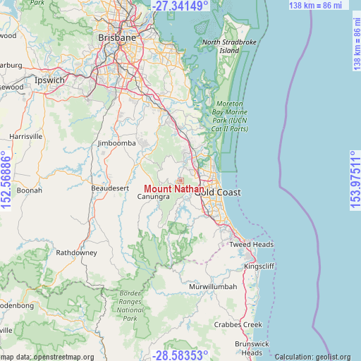
Mount Nathan GPS coordinates[2]
27° 57' 51.48" South, 153° 16' 19.128" East
| Map corner | latitude | longitude |
|---|---|---|
| Upper-left | -27.34149°, | 152.56886° |
| Center: | -27.9643°, | 153.27198° |
| Lower-right: | -28.58353°, | 153.97511° |
| Map W x H: | 138.1×138.1 km | = 85.8×85.8mi |
| max Lat: | -10.58257° ⇑23.7% North |
| Mount Nathan: | -27.9643° |
| min Lat: | ⇓76.3% South -43.31423° |
| min Long | Mount Nathan | max Long |
| 113.53327° | 153.27198° | 153.61246° |
| W 97.4%⇐ | ⇒2.6% E |
Elevation
Elevation of Mount Nathan is 38 m = 125 ft, and this is 84 m = 276 ft below average elevation for this country.
| Max E: |
1715 m = 5627 ft | 55.2% |
| Avg. | 122 m = 400 ft | |
| Mount Nathan | 38 m = 125 ft | |
Min E: |
-2 m = -7 ft | 44.8% |
See also: Australia elevation on elevation.city.
Geographical zone
Mount Nathan is located in South temperate zone (between Tropic of Capricorn and the Antarctic Circle). Distance of this Southern Tropic circle is 503.4 km =312.8 mi to North.| Distance of | km | miles | from Mount Nathan |
|---|---|---|---|
| Equator | 3109.3 | 1932 | to North |
| Tropic Capricorn | 503.4 | 312.8 | to North |
| Antarctic Circle | 4291.8 | 2666.8 | to South |
| South Pole | 6897.7 | 4286 | to South |


Nearby cities:
15 places around Mount Nathan: (largest is in red/bold)
• Arundel
9.4 km =5.8 mi,  71°
71°
• Clagiraba
4.4 km =2.7 mi,  221°
221°
• Gaven
6.2 km =3.9 mi,  81°
81°
• Gilston
8.2 km =5.1 mi,  160°
160°
• Guanaba
4.3 km =2.7 mi,  312°
312°
• Helensvale
7.9 km =4.9 mi,  49°
49°
• Highland Park
8.2 km =5.1 mi,  132°
132°
• Lower Beechmont
9.6 km =6 mi,  195°
195°
• Maudsland
1.7 km =1.1 mi,  341°
341°
• Molendinar
8.8 km =5.5 mi,  97°
97°
• Nerang
6.9 km =4.3 mi,  113°
113°
• Oxenford
9.2 km =5.7 mi,  26°
26°
• Pacific Pines
5 km =3.1 mi,  56°
56°
• Parkwood
9 km =5.6 mi, 83°
• Tamborine Mountain
7.2 km =4.5 mi,  265°
265°
Sources, notices
• [Note1] Compared only with cities in Australia existing in our database
• [Src1] Map data: © OpenStreetMap contributors (CC-BY-SA)
• [Src2] Other city data from geonames.org with taken over terms of usage.
• [Src3] Geographical zone / Annual Mean Temperature by Robert A. Rohde @ Wikipedia
