Mathoura geodata
Mathoura (New South Wales) is a populated place; located in Australia in Australia/Sydney (GMT+11) time zone. With population of 933 people, there are 3926 cities with bigger population in this country. Compared to other cities in Australia, 77.9% of cities are located further ↑North; 67.8% of cities are located further →East and 71.5% of cities have lower elevation than Mathoura. Note1


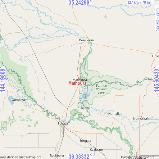
Mathoura GPS coordinates[2]
35° 48' 54.72" South, 144° 54' 4.32" East
| Map corner | latitude | longitude |
|---|---|---|
| Upper-left | -35.24299°, | 144.19808° |
| Center: | -35.8152°, | 144.9012° |
| Lower-right: | -36.38332°, | 145.60433° |
| Map W x H: | 126.8×126.8 km | = 78.8×78.8mi |
| max Lat: | -10.58257° ⇑77.9% North |
| Mathoura: | -35.8152° |
| min Lat: | ⇓22.1% South -43.31423° |
| min Long | Mathoura | max Long |
| 113.53327° | 144.9012° | 153.61246° |
| W 32.2%⇐ | ⇒67.8% E |
Elevation
Elevation of Mathoura is 110 m = 361 ft, and this is 12 m = 39 ft below average elevation for this country.
| Max E: |
1715 m = 5627 ft | 28.5% |
| Avg. | 122 m = 400 ft | |
| Mathoura | 110 m = 361 ft | |
Min E: |
-2 m = -7 ft | 71.5% |
See also: Australia elevation on elevation.city.
Geographical zone
Mathoura is located in South temperate zone (between Tropic of Capricorn and the Antarctic Circle). Distance of this Southern Tropic circle is 1376.4 km =855.3 mi to North.| Distance of | km | miles | from Mathoura |
|---|---|---|---|
| Equator | 3982.3 | 2474.5 | to North |
| Tropic Capricorn | 1376.4 | 855.3 | to North |
| Antarctic Circle | 3418.9 | 2124.4 | to South |
| South Pole | 6024.8 | 3743.6 | to South |


Nearby cities:
15 places around Mathoura: (largest is in red/bold)
• Deniliquin
31.8 km =19.8 mi,  8°
8°
• Echuca
38.6 km =24 mi,  200°
200°
• Echuca Village
36.2 km =22.5 mi,  192°
192°
• Gunbower
50.4 km =31.3 mi,  251°
251°
• Katunga
55.7 km =34.6 mi,  113°
113°
• Kyabram
57 km =35.4 mi,  166°
166°
• Leitchville
54.9 km =34.1 mi,  259°
259°
• Lockington
60.3 km =37.5 mi,  212°
212°
• Moama
34.5 km =21.4 mi, 201°
• Nathalia
38.3 km =23.8 mi,  134°
134°
• Numurkah
57.4 km =35.7 mi,  121°
121°
• Strathmerton
53.5 km =33.2 mi,  103°
103°
• Tocumwal
60.2 km =37.4 mi,  89°
89°
• Tongala
49.1 km =30.5 mi, 174°
• Yarroweyah
60.3 km =37.5 mi, 101°
Sources, notices
• [Note1] Compared only with cities in Australia existing in our database
• [Src1] Map data: © OpenStreetMap contributors (CC-BY-SA)
• [Src2] Other city data from geonames.org with taken over terms of usage.
• [Src3] Geographical zone / Annual Mean Temperature by Robert A. Rohde @ Wikipedia
