Mareeba geodata
Mareeba (Queensland) is a populated place; located in Australia in Australia/Brisbane (GMT+10) time zone. With population of 11,339 people, there are 475 cities with bigger population in this country. Compared to other cities in Australia, 97% of cities are located further ↓South; 60.2% of cities are located further →East and 90.9% of cities have lower elevation than Mareeba. Note1


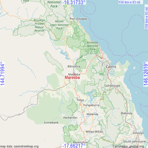
Mareeba GPS coordinates[2]
16° 59' 27.456" South, 145° 25' 23.016" East
| Map corner | latitude | longitude |
|---|---|---|
| Upper-left | -16.31733°, | 144.71994° |
| Center: | -16.99096°, | 145.42306° |
| Lower-right: | -17.66217°, | 146.12619° |
| Map W x H: | 149.5×149.5 km | = 92.9×92.9mi |
| max Lat: | -10.58257° ⇑3% North |
| Mareeba: | -16.99096° |
| min Lat: | ⇓97% South -43.31423° |
| min Long | Mareeba | max Long |
| 113.53327° | 145.42306° | 153.61246° |
| W 39.8%⇐ | ⇒60.2% E |
Elevation
Elevation of Mareeba is 408 m = 1339 ft, and this is 286 m = 938 ft above average elevation for this country.
| Max E: |
1715 m = 5627 ft | 9.1% |
| Mareeba | 408 m 1339 ft | |
| Avg. | 122 m = 400 ft | |
Min E: |
-2 m = -7 ft | 90.9% |
See also: Australia elevation on elevation.city.
Geographical zone
Mareeba is located in South Torrid zone (between Equator and Tropic of Capricorn). Distance of this Southern Tropic circle is 716.7 km =445.3 mi to South.| Distance of | km | miles | from Mareeba |
|---|---|---|---|
| Equator | 1889.2 | 1173.9 | to North |
| Tropic Capricorn | 716.7 | 445.3 | to South |
| Antarctic Circle | 5512 | 3425 | to South |
| South Pole | 8117.8 | 5044.2 | to South |


Nearby cities:
15 places around Mareeba: (largest is in red/bold)
• Atherton
31.4 km =19.5 mi,  169°
169°
• Bayview Heights
32.4 km =20.1 mi,  84°
84°
• Biboohra
14.1 km =8.8 mi,  4°
4°
• Brinsmead
32.7 km =20.3 mi,  71°
71°
• Caravonica
30.5 km =19 mi,  64°
64°
• Earlville
33.3 km =20.7 mi, 82°
• Kamerunga
32.4 km =20.1 mi, 66°
• Kanimbla
32.6 km =20.3 mi, 76°
• Koah
18 km =11.2 mi,  49°
49°
• Kuranda
29.8 km =18.5 mi, 50°
• Mount Sheridan
32.9 km =20.4 mi,  89°
89°
• Redlynch
29.9 km =18.6 mi, 75°
• Speewah
23.2 km =14.4 mi, 60°
• Tolga
22.4 km =13.9 mi, 165°
• Walkamin
16.2 km =10.1 mi,  182°
182°
Sources, notices
• [Note1] Compared only with cities in Australia existing in our database
• [Src1] Map data: © OpenStreetMap contributors (CC-BY-SA)
• [Src2] Other city data from geonames.org with taken over terms of usage.
• [Src3] Geographical zone / Annual Mean Temperature by Robert A. Rohde @ Wikipedia
