Mapleton geodata
Mapleton (Queensland) is a section of populated place; located in Australia in Australia/Brisbane (GMT+10) time zone. With population of 1,568 people, there are 3217 cities with bigger population in this country. Compared to other cities in Australia, 87.1% of cities are located further ↓South; 88.1% of cities are located further ←West and 90% of cities have lower elevation than Mapleton. Note1


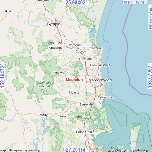
Mapleton GPS coordinates[2]
26° 37' 27.516" South, 152° 52' 4.224" East
| Map corner | latitude | longitude |
|---|---|---|
| Upper-left | -25.99402°, | 152.16472° |
| Center: | -26.62431°, | 152.86784° |
| Lower-right: | -27.25114°, | 153.57097° |
| Map W x H: | 139.8×139.8 km | = 86.9×86.9mi |
| max Lat: | -10.58257° ⇑12.9% North |
| Mapleton: | -26.62431° |
| min Lat: | ⇓87.1% South -43.31423° |
| min Long | Mapleton | max Long |
| 113.53327° | 152.86784° | 153.61246° |
| W 88.1%⇐ | ⇒11.9% E |
Elevation
Elevation of Mapleton is 371 m = 1217 ft, and this is 249 m = 817 ft above average elevation for this country.
| Max E: |
1715 m = 5627 ft | 10% |
| Mapleton | 371 m 1217 ft | |
| Avg. | 122 m = 400 ft | |
Min E: |
-2 m = -7 ft | 90% |
See also: Australia elevation on elevation.city.
Geographical zone
Mapleton is located in South temperate zone (between Tropic of Capricorn and the Antarctic Circle). Distance of this Southern Tropic circle is 354.4 km =220.2 mi to North.| Distance of | km | miles | from Mapleton |
|---|---|---|---|
| Equator | 2960.3 | 1839.4 | to North |
| Tropic Capricorn | 354.4 | 220.2 | to North |
| Antarctic Circle | 4440.8 | 2759.4 | to South |
| South Pole | 7046.7 | 4378.6 | to South |


Nearby cities:
15 places around Mapleton: (largest is in red/bold)
• Belli Park
13.7 km =8.5 mi,  340°
340°
• Burnside
7.3 km =4.5 mi,  97°
97°
• Coes Creek
8.5 km =5.3 mi,  107°
107°
• Dulong
4 km =2.5 mi, 105°
• Flaxton
3.7 km =2.3 mi,  185°
185°
• Hunchy
7.5 km =4.7 mi,  145°
145°
• Kureelpa
3 km =1.9 mi,  49°
49°
• Montville
6.7 km =4.2 mi,  166°
166°
• Nambour
9.1 km =5.7 mi,  91°
91°
• Palmwoods
11.5 km =7.1 mi,  126°
126°
• Rosemount
13.1 km =8.1 mi, 92°
• West Woombye
7.4 km =4.6 mi, 129°
• Witta
9.8 km =6.1 mi,  211°
211°
• Woombye
10.9 km =6.8 mi, 111°
• Yandina
11.2 km =7 mi, 51°
Sources, notices
• [Note1] Compared only with cities in Australia existing in our database
• [Src1] Map data: © OpenStreetMap contributors (CC-BY-SA)
• [Src2] Other city data from geonames.org with taken over terms of usage.
• [Src3] Geographical zone / Annual Mean Temperature by Robert A. Rohde @ Wikipedia
