Pormpuraaw geodata
Pormpuraaw (Queensland) is a populated place; located in Australia in Australia/Brisbane (GMT+10) time zone. With population of 783 people, there are 4176 cities with bigger population in this country. Compared to other cities in Australia, 98.1% of cities are located further ↓South; 75.2% of cities are located further →East and 91.8% of cities have higher elevation than Pormpuraaw. Note1


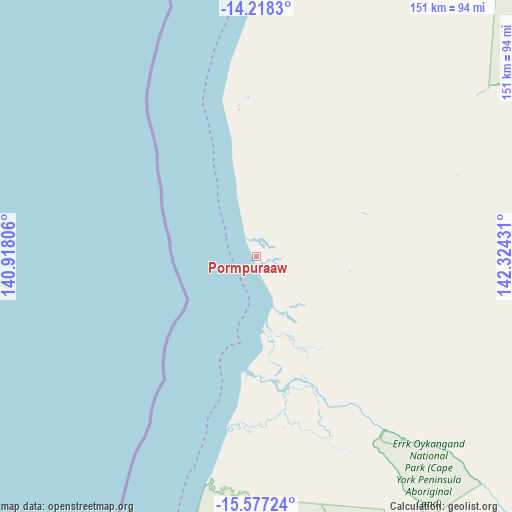
Pormpuraaw GPS coordinates[2]
14° 53' 55.824" South, 141° 37' 16.248" East
| Map corner | latitude | longitude |
|---|---|---|
| Upper-left | -14.2183°, | 140.91806° |
| Center: | -14.89884°, | 141.62118° |
| Lower-right: | -15.57724°, | 142.32431° |
| Map W x H: | 151.1×151.1 km | = 93.9×93.9mi |
| max Lat: | -10.58257° ⇑1.9% North |
| Pormpuraaw: | -14.89884° |
| min Lat: | ⇓98.1% South -43.31423° |
| min Long | Pormpuraaw | max Long |
| 113.53327° | 141.62118° | 153.61246° |
| W 24.8%⇐ | ⇒75.2% E |
Elevation
Elevation of Pormpuraaw is 8 m = 26 ft, and this is 114 m = 374 ft below average elevation for this country.
| Max E: |
1715 m = 5627 ft | 91.8% |
| Avg. | 122 m = 400 ft | |
| Pormpuraaw | 8 m = 26 ft | |
Min E: |
-2 m = -7 ft | 8.2% |
See also: Australia elevation on elevation.city.
Geographical zone
Pormpuraaw is located in South Torrid zone (between Equator and Tropic of Capricorn). Distance of this Southern Tropic circle is 949.3 km =589.9 mi to South.| Distance of | km | miles | from Pormpuraaw |
|---|---|---|---|
| Equator | 1656.6 | 1029.4 | to North |
| Tropic Capricorn | 949.3 | 589.9 | to South |
| Antarctic Circle | 5744.6 | 3569.5 | to South |
| South Pole | 8350.5 | 5188.8 | to South |


Nearby cities:
14 places around Pormpuraaw: (largest is in red/bold)
• Aurukun
171.9 km =106.8 mi,  3°
3°
• Cooktown
394.4 km =245.1 mi,  99°
99°
• Hope Vale
377.2 km =234.4 mi, 96°
• Injinoo
432.8 km =268.9 mi,  9°
9°
• Karumba
299.5 km =186.1 mi,  196°
196°
• Kowanyama
65.3 km =40.6 mi,  168°
168°
• Laura
285.1 km =177.2 mi, 104°
• Lockhart River
299.5 km =186.1 mi,  38°
38°
• Mission River
258.7 km =160.7 mi, 8°
• Nanum
251.9 km =156.5 mi, 5°
• Normanton
313.7 km =194.9 mi,  190°
190°
• Trunding
253.2 km =157.3 mi, 6°
• Weipa
254.5 km =158.1 mi, 6°
• Wellesley Islands
305.9 km =190.1 mi,  230°
230°
Sources, notices
• [Note1] Compared only with cities in Australia existing in our database
• [Src1] Map data: © OpenStreetMap contributors (CC-BY-SA)
• [Src2] Other city data from geonames.org with taken over terms of usage.
• [Src3] Geographical zone / Annual Mean Temperature by Robert A. Rohde @ Wikipedia
