Kowanyama geodata
Kowanyama (Queensland) is a populated place; located in Australia in Australia/Brisbane (GMT+10) time zone. With population of 964 people, there are 3877 cities with bigger population in this country. Compared to other cities in Australia, 98% of cities are located further ↓South; 75.1% of cities are located further →East and 80.4% of cities have higher elevation than Kowanyama. Note1


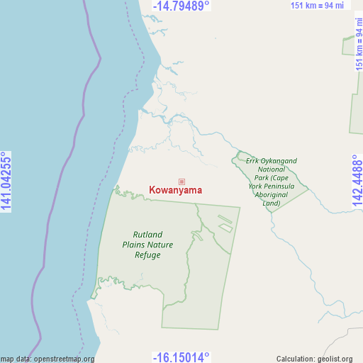
Kowanyama GPS coordinates[2]
15° 28' 25.032" South, 141° 44' 44.412" East
| Map corner | latitude | longitude |
|---|---|---|
| Upper-left | -14.79489°, | 141.04255° |
| Center: | -15.47362°, | 141.74567° |
| Lower-right: | -16.15014°, | 142.4488° |
| Map W x H: | 150.7×150.7 km | = 93.6×93.6mi |
| max Lat: | -10.58257° ⇑2% North |
| Kowanyama: | -15.47362° |
| min Lat: | ⇓98% South -43.31423° |
| min Long | Kowanyama | max Long |
| 113.53327° | 141.74567° | 153.61246° |
| W 24.9%⇐ | ⇒75.1% E |
Elevation
Elevation of Kowanyama is 15 m = 49 ft, and this is 107 m = 351 ft below average elevation for this country.
| Max E: |
1715 m = 5627 ft | 80.4% |
| Avg. | 122 m = 400 ft | |
| Kowanyama | 15 m = 49 ft | |
Min E: |
-2 m = -7 ft | 19.6% |
See also: Australia elevation on elevation.city.
Geographical zone
Kowanyama is located in South Torrid zone (between Equator and Tropic of Capricorn). Distance of this Southern Tropic circle is 885.4 km =550.2 mi to South.| Distance of | km | miles | from Kowanyama |
|---|---|---|---|
| Equator | 1720.5 | 1069.1 | to North |
| Tropic Capricorn | 885.4 | 550.2 | to South |
| Antarctic Circle | 5680.7 | 3529.8 | to South |
| South Pole | 8286.6 | 5149.1 | to South |


Nearby cities:
15 places around Kowanyama: (largest is in red/bold)
• Aurukun
235.5 km =146.3 mi,  359°
359°
• Cooktown
375.5 km =233.3 mi,  89°
89°
• Hope Vale
361.3 km =224.5 mi, 86°
• Julatten
404.4 km =251.3 mi,  108°
108°
• Karumba
243.7 km =151.4 mi,  203°
203°
• Laura
262.9 km =163.4 mi, 91°
• Lockhart River
344.8 km =214.2 mi,  29°
29°
• Mission River
320.9 km =199.4 mi,  4°
4°
• Mossman
402.9 km =250.4 mi, 105°
• Nanum
314.8 km =195.6 mi, 2°
• Normanton
254.6 km =158.2 mi, 196°
• Pormpuraaw
65.3 km =40.6 mi,  348°
348°
• Trunding
316 km =196.4 mi, 2°
• Weipa
317.2 km =197.1 mi, 2°
• Wellesley Islands
281.7 km =175 mi,  242°
242°
Sources, notices
• [Note1] Compared only with cities in Australia existing in our database
• [Src1] Map data: © OpenStreetMap contributors (CC-BY-SA)
• [Src2] Other city data from geonames.org with taken over terms of usage.
• [Src3] Geographical zone / Annual Mean Temperature by Robert A. Rohde @ Wikipedia
