Healesville geodata
Healesville (Victoria) is a populated place; located in Australia in Australia/Melbourne (GMT+11) time zone. With population of 7,382 people, there are 917 cities with bigger population in this country. Compared to other cities in Australia, 84% of cities are located further ↑North; 59.6% of cities are located further →East and 69.1% of cities have lower elevation than Healesville. Note1


Healesville GPS coordinates[2]
37° 39' 14.22" South, 145° 31' 1.848" East
| Map corner | latitude | longitude |
|---|---|---|
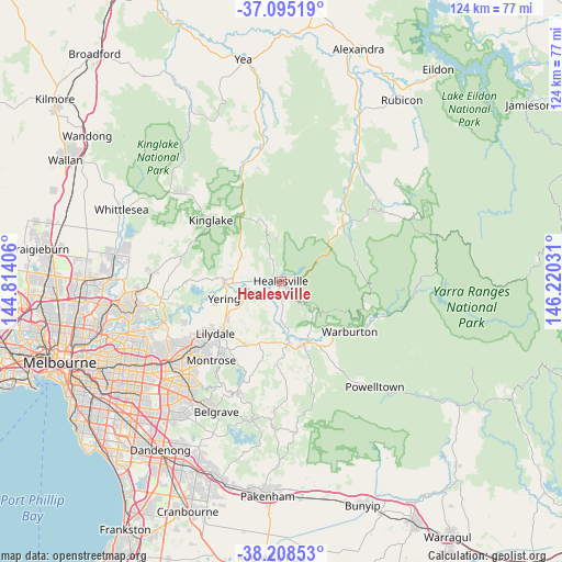
| Upper-left | -37.09519°, | 144.81406° |
| Center: | -37.65395°, | 145.51718° |
| Lower-right: | -38.20853°, | 146.22031° |
| Map W x H: | 123.8×123.8 km | = 76.9×76.9mi |
| max Lat: | -10.58257° ⇑84% North |
| Healesville: | -37.65395° |
| min Lat: | ⇓16% South -43.31423° |
| min Long | Healesville | max Long |
| 113.53327° | 145.51718° | 153.61246° |
| W 40.4%⇐ | ⇒59.6% E |
Elevation
Elevation of Healesville is 97 m = 318 ft, and this is 25 m = 82 ft below average elevation for this country.
| Max E: |
1715 m = 5627 ft | 30.9% |
| Avg. | 122 m = 400 ft | |
| Healesville | 97 m = 318 ft | |
Min E: |
-2 m = -7 ft | 69.1% |
See also: Australia elevation on elevation.city.
Geographical zone
Healesville is located in South temperate zone (between Tropic of Capricorn and the Antarctic Circle). Distance of this Southern Tropic circle is 1580.8 km =982.3 mi to North.| Distance of | km | miles | from Healesville |
|---|---|---|---|
| Equator | 4186.7 | 2601.5 | to North |
| Tropic Capricorn | 1580.8 | 982.3 | to North |
| Antarctic Circle | 3214.4 | 1997.3 | to South |
| South Pole | 5820.3 | 3616.6 | to South |


Nearby cities:
15 places around Healesville: (largest is in red/bold)
• Badger Creek
5.1 km =3.2 mi,  180°
180°
• Chum Creek
6 km =3.7 mi,  334°
334°
• Coldstream
14.6 km =9.1 mi,  237°
237°
• Don Valley
11.3 km =7 mi,  144°
144°
• Gruyere
10.6 km =6.6 mi,  213°
213°
• Launching Place
14.8 km =9.2 mi,  162°
162°
• Lilydale
18.2 km =11.3 mi,  234°
234°
• Millgrove
16.5 km =10.3 mi,  133°
133°
• Seville
16.2 km =10.1 mi,  189°
189°
• Seville East
13.6 km =8.5 mi, 187°
• Wandin North
16.2 km =10.1 mi, 207°
• Wesburn
16.2 km =10.1 mi, 140°
• Woori Yallock
14.2 km =8.8 mi,  172°
172°
• Yarra Glen
12.6 km =7.8 mi,  267°
267°
• Yarra Junction
16.6 km =10.3 mi,  149°
149°
Sources, notices
• [Note1] Compared only with cities in Australia existing in our database
• [Src1] Map data: © OpenStreetMap contributors (CC-BY-SA)
• [Src2] Other city data from geonames.org with taken over terms of usage.
• [Src3] Geographical zone / Annual Mean Temperature by Robert A. Rohde @ Wikipedia
