Goomeri geodata
Goomeri (Queensland) is a populated place; located in Australia in Australia/Brisbane (GMT+10) time zone. With population of 675 people, there are 4372 cities with bigger population in this country. Compared to other cities in Australia, 88.4% of cities are located further ↓South; 82.9% of cities are located further ←West and 85.1% of cities have lower elevation than Goomeri. Note1


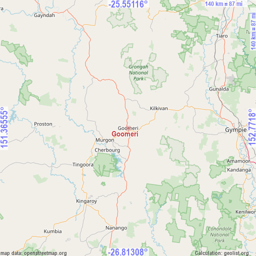
Goomeri GPS coordinates[2]
26° 11' 1.788" South, 152° 4' 7.212" East
| Map corner | latitude | longitude |
|---|---|---|
| Upper-left | -25.55116°, | 151.36555° |
| Center: | -26.18383°, | 152.06867° |
| Lower-right: | -26.81308°, | 152.7718° |
| Map W x H: | 140.3×140.3 km | = 87.2×87.2mi |
| max Lat: | -10.58257° ⇑11.6% North |
| Goomeri: | -26.18383° |
| min Lat: | ⇓88.4% South -43.31423° |
| min Long | Goomeri | max Long |
| 113.53327° | 152.06867° | 153.61246° |
| W 82.9%⇐ | ⇒17.1% E |
Elevation
Elevation of Goomeri is 248 m = 814 ft, and this is 126 m = 413 ft above average elevation for this country.
| Max E: |
1715 m = 5627 ft | 14.9% |
| Goomeri | 248 m 814 ft | |
| Avg. | 122 m = 400 ft | |
Min E: |
-2 m = -7 ft | 85.1% |
See also: Australia elevation on elevation.city.
Geographical zone
Goomeri is located in South temperate zone (between Tropic of Capricorn and the Antarctic Circle). Distance of this Southern Tropic circle is 305.4 km =189.8 mi to North.| Distance of | km | miles | from Goomeri |
|---|---|---|---|
| Equator | 2911.4 | 1809.1 | to North |
| Tropic Capricorn | 305.4 | 189.8 | to North |
| Antarctic Circle | 4489.8 | 2789.8 | to South |
| South Pole | 7095.7 | 4409.1 | to South |


Nearby cities:
15 places around Goomeri: (largest is in red/bold)
• Booie
41.2 km =25.6 mi,  197°
197°
• Chatsworth
54.7 km =34 mi,  85°
85°
• Cherbourg
16.7 km =10.4 mi,  224°
224°
• Curra
53 km =32.9 mi,  75°
75°
• Kilkivan
19.7 km =12.2 mi,  56°
56°
• Kingaroy
45.8 km =28.5 mi,  210°
210°
• Murgon
14.3 km =8.9 mi,  243°
243°
• Nanango
54.6 km =33.9 mi,  186°
186°
• Pie Creek
54 km =33.6 mi,  95°
95°
• Southside
57.8 km =35.9 mi, 92°
• Taabinga
50.2 km =31.2 mi, 207°
• The Palms
51.7 km =32.1 mi, 92°
• Wattle Camp
32.2 km =20 mi, 199°
• Widgee
36.3 km =22.6 mi, 95°
• Wondai
24.6 km =15.3 mi,  232°
232°
Sources, notices
• [Note1] Compared only with cities in Australia existing in our database
• [Src1] Map data: © OpenStreetMap contributors (CC-BY-SA)
• [Src2] Other city data from geonames.org with taken over terms of usage.
• [Src3] Geographical zone / Annual Mean Temperature by Robert A. Rohde @ Wikipedia
