Glenorie geodata
Glenorie (New South Wales) is a section of populated place; located in Australia in Australia/Sydney (GMT+11) time zone. With population of 3,424 people, there are 2017 cities with bigger population in this country. Compared to other cities in Australia, 52.6% of cities are located further ↓South; 67.7% of cities are located further ←West and 78.5% of cities have lower elevation than Glenorie. Note1


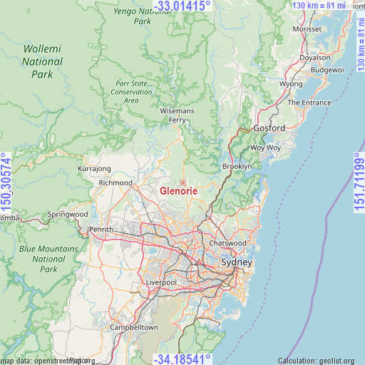
Glenorie GPS coordinates[2]
33° 36' 6.372" South, 151° 0' 31.896" East
| Map corner | latitude | longitude |
|---|---|---|
| Upper-left | -33.01415°, | 150.30574° |
| Center: | -33.60177°, | 151.00886° |
| Lower-right: | -34.18541°, | 151.71199° |
| Map W x H: | 130.2×130.2 km | = 80.9×80.9mi |
| max Lat: | -10.58257° ⇑47.4% North |
| Glenorie: | -33.60177° |
| min Lat: | ⇓52.6% South -43.31423° |
| min Long | Glenorie | max Long |
| 113.53327° | 151.00886° | 153.61246° |
| W 67.7%⇐ | ⇒32.3% E |
Elevation
Elevation of Glenorie is 163 m = 535 ft, and this is 41 m = 135 ft above average elevation for this country.
| Max E: |
1715 m = 5627 ft | 21.5% |
| Glenorie | 163 m 535 ft | |
| Avg. | 122 m = 400 ft | |
Min E: |
-2 m = -7 ft | 78.5% |
See also: Australia elevation on elevation.city.
Geographical zone
Glenorie is located in South temperate zone (between Tropic of Capricorn and the Antarctic Circle). Distance of this Southern Tropic circle is 1130.2 km =702.3 mi to North.| Distance of | km | miles | from Glenorie |
|---|---|---|---|
| Equator | 3736.2 | 2321.6 | to North |
| Tropic Capricorn | 1130.2 | 702.3 | to North |
| Antarctic Circle | 3665 | 2277.3 | to South |
| South Pole | 6270.9 | 3896.6 | to South |


Nearby cities:
15 places around Glenorie: (largest is in red/bold)
• Annangrove
8.4 km =5.2 mi,  222°
222°
• Arcadia
2.8 km =1.7 mi,  126°
126°
• Berowra Heights
12 km =7.5 mi,  95°
95°
• Cattai
10.8 km =6.7 mi,  305°
305°
• Dural
9.1 km =5.7 mi,  175°
175°
• Galston
6.7 km =4.2 mi,  148°
148°
• Glenhaven
11 km =6.8 mi, 184°
• Hornsby Heights
11.1 km =6.9 mi, 134°
• Kenthurst
6 km =3.7 mi, 183°
• Maraylya
8.3 km =5.2 mi,  277°
277°
• Middle Dural
4.3 km =2.7 mi,  169°
169°
• Mount Kuring-Gai
12 km =7.5 mi,  111°
111°
• Oakville
12 km =7.5 mi,  262°
262°
• Rouse Hill
12.4 km =7.7 mi, 224°
• South Maroota
11.9 km =7.4 mi,  336°
336°
Sources, notices
• [Note1] Compared only with cities in Australia existing in our database
• [Src1] Map data: © OpenStreetMap contributors (CC-BY-SA)
• [Src2] Other city data from geonames.org with taken over terms of usage.
• [Src3] Geographical zone / Annual Mean Temperature by Robert A. Rohde @ Wikipedia
