Gerringong geodata
Gerringong (New South Wales) is a section of populated place; located in Australia in Australia/Sydney (GMT+11) time zone. With population of 3,869 people, there are 1839 cities with bigger population in this country. Compared to other cities in Australia, 65.2% of cities are located further ↑North; 63.2% of cities are located further ←West and 54% of cities have lower elevation than Gerringong. Note1


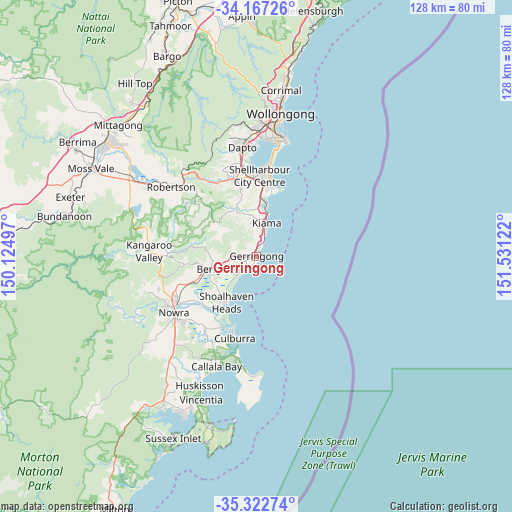
Gerringong GPS coordinates[2]
34° 44' 49.272" South, 150° 49' 41.124" East
| Map corner | latitude | longitude |
|---|---|---|
| Upper-left | -34.16726°, | 150.12497° |
| Center: | -34.74702°, | 150.82809° |
| Lower-right: | -35.32274°, | 151.53122° |
| Map W x H: | 128.5×128.5 km | = 79.8×79.8mi |
| max Lat: | -10.58257° ⇑65.2% North |
| Gerringong: | -34.74702° |
| min Lat: | ⇓34.8% South -43.31423° |
| min Long | Gerringong | max Long |
| 113.53327° | 150.82809° | 153.61246° |
| W 63.2%⇐ | ⇒36.8% E |
Elevation
Elevation of Gerringong is 51 m = 167 ft, and this is 71 m = 233 ft below average elevation for this country.
| Max E: |
1715 m = 5627 ft | 46% |
| Avg. | 122 m = 400 ft | |
| Gerringong | 51 m = 167 ft | |
Min E: |
-2 m = -7 ft | 54% |
See also: Australia elevation on elevation.city.
Geographical zone
Gerringong is located in South temperate zone (between Tropic of Capricorn and the Antarctic Circle). Distance of this Southern Tropic circle is 1257.6 km =781.4 mi to North.| Distance of | km | miles | from Gerringong |
|---|---|---|---|
| Equator | 3863.5 | 2400.7 | to North |
| Tropic Capricorn | 1257.6 | 781.4 | to North |
| Antarctic Circle | 3537.7 | 2198.2 | to South |
| South Pole | 6143.6 | 3817.5 | to South |


Nearby cities:
15 places around Gerringong: (largest is in red/bold)
• Berry
12.6 km =7.8 mi,  255°
255°
• Blackbutt
19.5 km =12.1 mi,  2°
2°
• Flinders
18.4 km =11.4 mi,  7°
7°
• Gerroa
3 km =1.9 mi,  213°
213°
• Greenwell Point
19.9 km =12.4 mi, 206°
• Jamberoo
12.1 km =7.5 mi,  336°
336°
• Kiama
9 km =5.6 mi, 14°
• Kiama Downs
12.9 km =8 mi, 10°
• Kiama Heights
5 km =3.1 mi, 10°
• Minnamurra
14 km =8.7 mi, 8°
• Orient Point
19.4 km =12.1 mi,  201°
201°
• Shell Cove
17.7 km =11 mi, 10°
• Shellharbour
18.5 km =11.5 mi, 10°
• Shoalhaven Heads
13.8 km =8.6 mi, 213°
• Werri Beach
1.2 km =0.7 mi, 12°
Sources, notices
• [Note1] Compared only with cities in Australia existing in our database
• [Src1] Map data: © OpenStreetMap contributors (CC-BY-SA)
• [Src2] Other city data from geonames.org with taken over terms of usage.
• [Src3] Geographical zone / Annual Mean Temperature by Robert A. Rohde @ Wikipedia
