Euston geodata
Euston (New South Wales) is a populated place; located in Australia in Australia/Sydney (GMT+11) time zone. With population of 887 people, there are 3993 cities with bigger population in this country. Compared to other cities in Australia, 63.8% of cities are located further ↑North; 74.2% of cities are located further →East and 56.9% of cities have lower elevation than Euston. Note1


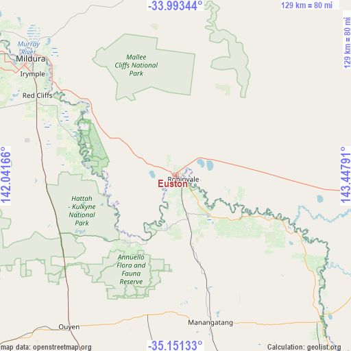
Euston GPS coordinates[2]
34° 34' 27.84" South, 142° 44' 41.208" East
| Map corner | latitude | longitude |
|---|---|---|
| Upper-left | -33.99344°, | 142.04166° |
| Center: | -34.5744°, | 142.74478° |
| Lower-right: | -35.15133°, | 143.44791° |
| Map W x H: | 128.7×128.7 km | = 80×80mi |
| max Lat: | -10.58257° ⇑63.8% North |
| Euston: | -34.5744° |
| min Lat: | ⇓36.2% South -43.31423° |
| min Long | Euston | max Long |
| 113.53327° | 142.74478° | 153.61246° |
| W 25.8%⇐ | ⇒74.2% E |
Elevation
Elevation of Euston is 57 m = 187 ft, and this is 65 m = 213 ft below average elevation for this country.
| Max E: |
1715 m = 5627 ft | 43.1% |
| Avg. | 122 m = 400 ft | |
| Euston | 57 m = 187 ft | |
Min E: |
-2 m = -7 ft | 56.9% |
See also: Australia elevation on elevation.city.
Geographical zone
Euston is located in South temperate zone (between Tropic of Capricorn and the Antarctic Circle). Distance of this Southern Tropic circle is 1238.4 km =769.5 mi to North.| Distance of | km | miles | from Euston |
|---|---|---|---|
| Equator | 3844.3 | 2388.7 | to North |
| Tropic Capricorn | 1238.4 | 769.5 | to North |
| Antarctic Circle | 3556.9 | 2210.2 | to South |
| South Pole | 6162.7 | 3829.3 | to South |


Nearby cities:
15 places around Euston: (largest is in red/bold)
• Balranald
75.1 km =46.7 mi,  95°
95°
• Birdwoodton
74.6 km =46.4 mi,  303°
303°
• Buronga
69 km =42.9 mi,  310°
310°
• Cardross
64.1 km =39.8 mi, 297°
• Coomealla
79.9 km =49.6 mi, 311°
• Dareton
83.9 km =52.1 mi, 309°
• Gol Gol
65.5 km =40.7 mi, 312°
• Irymple
64.7 km =40.2 mi, 305°
• Merbein
77 km =47.8 mi, 305°
• Mildura
68.7 km =42.7 mi, 308°
• Nichols Point
63.2 km =39.3 mi, 309°
• Nyah West
87.6 km =54.4 mi,  140°
140°
• Ouyen
67.4 km =41.9 mi,  215°
215°
• Red Cliffs
58.8 km =36.5 mi, 300°
• Robinvale
2.7 km =1.7 mi,  112°
112°
Sources, notices
• [Note1] Compared only with cities in Australia existing in our database
• [Src1] Map data: © OpenStreetMap contributors (CC-BY-SA)
• [Src2] Other city data from geonames.org with taken over terms of usage.
• [Src3] Geographical zone / Annual Mean Temperature by Robert A. Rohde @ Wikipedia
