Chewton geodata
Chewton (Victoria) is a populated place; located in Australia in Australia/Melbourne (GMT+11) time zone. With population of 1,309 people, there are 3463 cities with bigger population in this country. Compared to other cities in Australia, 81.7% of cities are located further ↑North; 71.8% of cities are located further →East and 88.2% of cities have lower elevation than Chewton. Note1


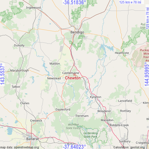
Chewton GPS coordinates[2]
37° 4' 52.932" South, 144° 15' 24.552" East
| Map corner | latitude | longitude |
|---|---|---|
| Upper-left | -36.51836°, | 143.5537° |
| Center: | -37.08137°, | 144.25682° |
| Lower-right: | -37.64023°, | 144.95995° |
| Map W x H: | 124.7×124.7 km | = 77.5×77.5mi |
| max Lat: | -10.58257° ⇑81.7% North |
| Chewton: | -37.08137° |
| min Lat: | ⇓18.3% South -43.31423° |
| min Long | Chewton | max Long |
| 113.53327° | 144.25682° | 153.61246° |
| W 28.2%⇐ | ⇒71.8% E |
Elevation
Elevation of Chewton is 320 m = 1050 ft, and this is 198 m = 650 ft above average elevation for this country.
| Max E: |
1715 m = 5627 ft | 11.8% |
| Chewton | 320 m 1050 ft | |
| Avg. | 122 m = 400 ft | |
Min E: |
-2 m = -7 ft | 88.2% |
See also: Australia elevation on elevation.city.
Geographical zone
Chewton is located in South temperate zone (between Tropic of Capricorn and the Antarctic Circle). Distance of this Southern Tropic circle is 1517.1 km =942.7 mi to North.| Distance of | km | miles | from Chewton |
|---|---|---|---|
| Equator | 4123.1 | 2562 | to North |
| Tropic Capricorn | 1517.1 | 942.7 | to North |
| Antarctic Circle | 3278.1 | 2036.9 | to South |
| South Pole | 5884 | 3656.1 | to South |


Nearby cities:
15 places around Chewton: (largest is in red/bold)
• Campbells Creek
4.9 km =3 mi,  263°
263°
• Castlemaine
3.9 km =2.4 mi,  294°
294°
• Daylesford
30.6 km =19 mi,  199°
199°
• Elphinstone
7.1 km =4.4 mi,  106°
106°
• Eppalock
31.2 km =19.4 mi,  35°
35°
• Harcourt
9.1 km =5.7 mi,  1°
1°
• Hepburn
28.4 km =17.6 mi, 202°
• Kyneton
25 km =15.5 mi,  136°
136°
• Lockwood South
27.8 km =17.3 mi,  341°
341°
• Maldon
19.3 km =12 mi,  299°
299°
• Malmsbury
16.5 km =10.3 mi, 136°
• Mandurang
29.7 km =18.5 mi,  7°
7°
• Newstead
17.3 km =10.7 mi, 260°
• Sedgwick
22.7 km =14.1 mi, 13°
• Tylden
30.2 km =18.8 mi,  154°
154°
Sources, notices
• [Note1] Compared only with cities in Australia existing in our database
• [Src1] Map data: © OpenStreetMap contributors (CC-BY-SA)
• [Src2] Other city data from geonames.org with taken over terms of usage.
• [Src3] Geographical zone / Annual Mean Temperature by Robert A. Rohde @ Wikipedia
