Tylden geodata
Tylden (Victoria) is a populated place; located in Australia in Australia/Melbourne (GMT+11) time zone. With population of 516 people, there are 4827 cities with bigger population in this country. Compared to other cities in Australia, 82.2% of cities are located further ↑North; 70.5% of cities are located further →East and 95.4% of cities have lower elevation than Tylden. Note1


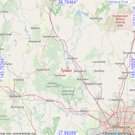
Tylden GPS coordinates[2]
37° 19' 33.024" South, 144° 24' 22.176" East
| Map corner | latitude | longitude |
|---|---|---|
| Upper-left | -36.76464°, | 143.70304° |
| Center: | -37.32584°, | 144.40616° |
| Lower-right: | -37.88288°, | 145.10929° |
| Map W x H: | 124.3×124.3 km | = 77.2×77.2mi |
| max Lat: | -10.58257° ⇑82.2% North |
| Tylden: | -37.32584° |
| min Lat: | ⇓17.8% South -43.31423° |
| min Long | Tylden | max Long |
| 113.53327° | 144.40616° | 153.61246° |
| W 29.5%⇐ | ⇒70.5% E |
Elevation
Elevation of Tylden is 591 m = 1939 ft, and this is 469 m = 1539 ft above average elevation for this country.
| Max E: |
1715 m = 5627 ft | 4.6% |
| Tylden | 591 m 1939 ft | |
| Avg. | 122 m = 400 ft | |
Min E: |
-2 m = -7 ft | 95.4% |
See also: Australia elevation on elevation.city.
Geographical zone
Tylden is located in South temperate zone (between Tropic of Capricorn and the Antarctic Circle). Distance of this Southern Tropic circle is 1544.3 km =959.6 mi to North.| Distance of | km | miles | from Tylden |
|---|---|---|---|
| Equator | 4150.2 | 2578.8 | to North |
| Tropic Capricorn | 1544.3 | 959.6 | to North |
| Antarctic Circle | 3250.9 | 2020 | to South |
| South Pole | 5856.8 | 3639.2 | to South |


Nearby cities:
15 places around Tylden: (largest is in red/bold)
• Bullengarook
22.3 km =13.9 mi,  162°
162°
• Daylesford
23.4 km =14.5 mi,  265°
265°
• Elphinstone
25.9 km =16.1 mi,  345°
345°
• Gisborne
24.6 km =15.3 mi,  137°
137°
• Gisborne South
29.7 km =18.5 mi, 143°
• Greendale
27.8 km =17.3 mi,  200°
200°
• Hepburn
24.1 km =15 mi, 272°
• Kyneton
9.9 km =6.2 mi,  23°
23°
• Lancefield
29.7 km =18.5 mi,  79°
79°
• Macedon
17.3 km =10.7 mi,  127°
127°
• Malmsbury
15.4 km =9.6 mi, 352°
• Mount Macedon
17.8 km =11.1 mi,  117°
117°
• New Gisborne
22.7 km =14.1 mi, 131°
• Trentham
10.2 km =6.3 mi,  226°
226°
• Woodend
11.3 km =7 mi,  106°
106°
Sources, notices
• [Note1] Compared only with cities in Australia existing in our database
• [Src1] Map data: © OpenStreetMap contributors (CC-BY-SA)
• [Src2] Other city data from geonames.org with taken over terms of usage.
• [Src3] Geographical zone / Annual Mean Temperature by Robert A. Rohde @ Wikipedia
