Benalla geodata
Benalla (Victoria) is a populated place; located in Australia in Australia/Melbourne (GMT+11) time zone. With population of 10,072 people, there are 594 cities with bigger population in this country. Compared to other cities in Australia, 80.1% of cities are located further ↑North; 57.2% of cities are located further →East and 79.4% of cities have lower elevation than Benalla. Note1


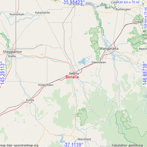
Benalla GPS coordinates[2]
36° 33' 4.068" South, 145° 59' 3.3" East
| Map corner | latitude | longitude |
|---|---|---|
| Upper-left | -35.98423°, | 145.28113° |
| Center: | -36.55113°, | 145.98425° |
| Lower-right: | -37.1139°, | 146.68738° |
| Map W x H: | 125.6×125.6 km | = 78×78mi |
| max Lat: | -10.58257° ⇑80.1% North |
| Benalla: | -36.55113° |
| min Lat: | ⇓19.9% South -43.31423° |
| min Long | Benalla | max Long |
| 113.53327° | 145.98425° | 153.61246° |
| W 42.8%⇐ | ⇒57.2% E |
Elevation
Elevation of Benalla is 173 m = 568 ft, and this is 51 m = 167 ft above average elevation for this country.
| Max E: |
1715 m = 5627 ft | 20.6% |
| Benalla | 173 m 568 ft | |
| Avg. | 122 m = 400 ft | |
Min E: |
-2 m = -7 ft | 79.4% |
See also: Australia elevation on elevation.city.
Geographical zone
Benalla is located in South temperate zone (between Tropic of Capricorn and the Antarctic Circle). Distance of this Southern Tropic circle is 1458.2 km =906.1 mi to North.| Distance of | km | miles | from Benalla |
|---|---|---|---|
| Equator | 4064.1 | 2525.3 | to North |
| Tropic Capricorn | 1458.2 | 906.1 | to North |
| Antarctic Circle | 3337.1 | 2073.6 | to South |
| South Pole | 5943 | 3692.8 | to South |


Nearby cities:
15 places around Benalla: (largest is in red/bold)
• Bonnie Doon
52.8 km =32.8 mi,  191°
191°
• Congupna
56.6 km =35.2 mi,  299°
299°
• Euroa
43.3 km =26.9 mi,  238°
238°
• Glenrowan
23.6 km =14.7 mi,  65°
65°
• Grahamvale
54 km =33.6 mi,  294°
294°
• Invergordon
55.8 km =34.7 mi,  319°
319°
• Kialla
52.2 km =32.4 mi,  282°
282°
• Mansfield
56.5 km =35.1 mi,  170°
170°
• Milawa
42.2 km =26.2 mi, 71°
• Oxley
36 km =22.4 mi, 71°
• Shepparton
55.7 km =34.6 mi, 289°
• Shepparton East
48.3 km =30 mi, 290°
• Violet Town
25.8 km =16 mi,  248°
248°
• Waldara
37.2 km =23.1 mi,  46°
46°
• Wangaratta
36.9 km =22.9 mi, 54°
Sources, notices
• [Note1] Compared only with cities in Australia existing in our database
• [Src1] Map data: © OpenStreetMap contributors (CC-BY-SA)
• [Src2] Other city data from geonames.org with taken over terms of usage.
• [Src3] Geographical zone / Annual Mean Temperature by Robert A. Rohde @ Wikipedia
