Glenrowan geodata
Glenrowan (Victoria) is a populated place; located in Australia in Australia/Melbourne (GMT+11) time zone. With population of 958 people, there are 3888 cities with bigger population in this country. Compared to other cities in Australia, 80% of cities are located further ↑North; 56.4% of cities are located further →East and 84.1% of cities have lower elevation than Glenrowan. Note1


Glenrowan GPS coordinates[2]
36° 27' 48.528" South, 146° 13' 28.164" East
| Map corner | latitude | longitude |
|---|---|---|
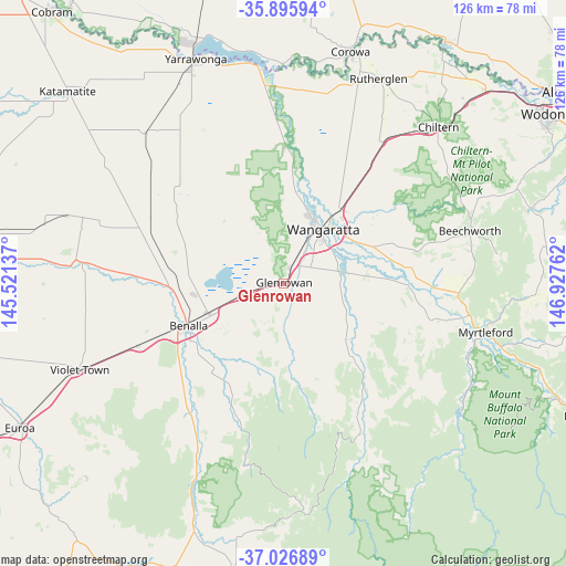
| Upper-left | -35.89594°, | 145.52137° |
| Center: | -36.46348°, | 146.22449° |
| Lower-right: | -37.02689°, | 146.92762° |
| Map W x H: | 125.7×125.7 km | = 78.1×78.1mi |
| max Lat: | -10.58257° ⇑80% North |
| Glenrowan: | -36.46348° |
| min Lat: | ⇓20% South -43.31423° |
| min Long | Glenrowan | max Long |
| 113.53327° | 146.22449° | 153.61246° |
| W 43.6%⇐ | ⇒56.4% E |
Elevation
Elevation of Glenrowan is 232 m = 761 ft, and this is 110 m = 361 ft above average elevation for this country.
| Max E: |
1715 m = 5627 ft | 15.9% |
| Glenrowan | 232 m 761 ft | |
| Avg. | 122 m = 400 ft | |
Min E: |
-2 m = -7 ft | 84.1% |
See also: Australia elevation on elevation.city.
Geographical zone
Glenrowan is located in South temperate zone (between Tropic of Capricorn and the Antarctic Circle). Distance of this Southern Tropic circle is 1448.4 km =900 mi to North.| Distance of | km | miles | from Glenrowan |
|---|---|---|---|
| Equator | 4054.4 | 2519.3 | to North |
| Tropic Capricorn | 1448.4 | 900 | to North |
| Antarctic Circle | 3346.8 | 2079.6 | to South |
| South Pole | 5952.7 | 3698.8 | to South |


Nearby cities:
15 places around Glenrowan: (largest is in red/bold)
• Barnawartha
56.9 km =35.4 mi,  45°
45°
• Beechworth
42.9 km =26.7 mi,  74°
74°
• Benalla
23.6 km =14.7 mi,  245°
245°
• Chiltern
48.9 km =30.4 mi,  44°
44°
• Corowa
53.8 km =33.4 mi,  15°
15°
• Milawa
19 km =11.8 mi,  79°
79°
• Mulwala
56.7 km =35.2 mi,  339°
339°
• Myrtleford
45.9 km =28.5 mi,  103°
103°
• Oxley
12.8 km =8 mi, 83°
• Rutherglen
50.2 km =31.2 mi,  25°
25°
• Violet Town
49.4 km =30.7 mi, 247°
• Wahgunyah
52.6 km =32.7 mi, 17°
• Waldara
16.8 km =10.4 mi, 18°
• Wangaratta
14.5 km =9 mi, 36°
• Yarrawonga
53.4 km =33.2 mi, 337°
Sources, notices
• [Note1] Compared only with cities in Australia existing in our database
• [Src1] Map data: © OpenStreetMap contributors (CC-BY-SA)
• [Src2] Other city data from geonames.org with taken over terms of usage.
• [Src3] Geographical zone / Annual Mean Temperature by Robert A. Rohde @ Wikipedia
