Beaconsfield geodata
Beaconsfield (Tasmania) is a populated place; located in Australia in Australia/Hobart (GMT+11) time zone. With population of 1,258 people, there are 3515 cities with bigger population in this country. Compared to other cities in Australia, 97% of cities are located further ↑North; 54.1% of cities are located further →East and 52.4% of cities have higher elevation than Beaconsfield. Note1


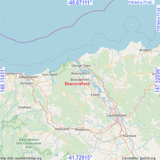
Beaconsfield GPS coordinates[2]
41° 12' 8.172" South, 146° 49' 2.028" East
| Map corner | latitude | longitude |
|---|---|---|
| Upper-left | -40.67111°, | 146.11411° |
| Center: | -41.20227°, | 146.81723° |
| Lower-right: | -41.72915°, | 147.52036° |
| Map W x H: | 117.6×117.6 km | = 73.1×73.1mi |
| max Lat: | -10.58257° ⇑97% North |
| Beaconsfield: | -41.20227° |
| min Lat: | ⇓3% South -43.31423° |
| min Long | Beaconsfield | max Long |
| 113.53327° | 146.81723° | 153.61246° |
| W 45.9%⇐ | ⇒54.1% E |
Elevation
Elevation of Beaconsfield is 42 m = 138 ft, and this is 80 m = 262 ft below average elevation for this country.
| Max E: |
1715 m = 5627 ft | 52.4% |
| Avg. | 122 m = 400 ft | |
| Beaconsfield | 42 m = 138 ft | |
Min E: |
-2 m = -7 ft | 47.6% |
See also: Australia elevation on elevation.city.
Geographical zone
Beaconsfield is located in South temperate zone (between Tropic of Capricorn and the Antarctic Circle). Distance of this Southern Tropic circle is 1975.3 km =1227.4 mi to North.| Distance of | km | miles | from Beaconsfield |
|---|---|---|---|
| Equator | 4581.3 | 2846.7 | to North |
| Tropic Capricorn | 1975.3 | 1227.4 | to North |
| Antarctic Circle | 2819.9 | 1752.2 | to South |
| South Pole | 5425.8 | 3371.4 | to South |


Nearby cities:
15 places around Beaconsfield: (largest is in red/bold)
• Beauty Point
4.5 km =2.8 mi,  4°
4°
• Dilston
25.1 km =15.6 mi,  124°
124°
• Exeter
15.4 km =9.6 mi,  133°
133°
• George Town
10.8 km =6.7 mi, 3°
• Gravelly Beach
16.2 km =10.1 mi, 125°
• Grindelwald
22.8 km =14.2 mi,  136°
136°
• Hillwood
14.7 km =9.1 mi,  108°
108°
• Latrobe
33.2 km =20.6 mi,  261°
261°
• Legana
26.4 km =16.4 mi, 133°
• Low Head
13.6 km =8.5 mi,  356°
356°
• Mayfield
33.3 km =20.7 mi, 128°
• Newnham
32.4 km =20.1 mi, 130°
• Port Sorell
22.5 km =14 mi,  280°
280°
• Riverside
31.2 km =19.4 mi, 141°
• Shearwater
24.4 km =15.2 mi, 281°
Sources, notices
• [Note1] Compared only with cities in Australia existing in our database
• [Src1] Map data: © OpenStreetMap contributors (CC-BY-SA)
• [Src2] Other city data from geonames.org with taken over terms of usage.
• [Src3] Geographical zone / Annual Mean Temperature by Robert A. Rohde @ Wikipedia
