Hillwood geodata
Hillwood (Tasmania) is a populated place; located in Australia in Australia/Hobart (GMT+11) time zone. With population of 571 people, there are 4646 cities with bigger population in this country. Compared to other cities in Australia, 97.1% of cities are located further ↑North; 53.2% of cities are located further →East and 52% of cities have lower elevation than Hillwood. Note1


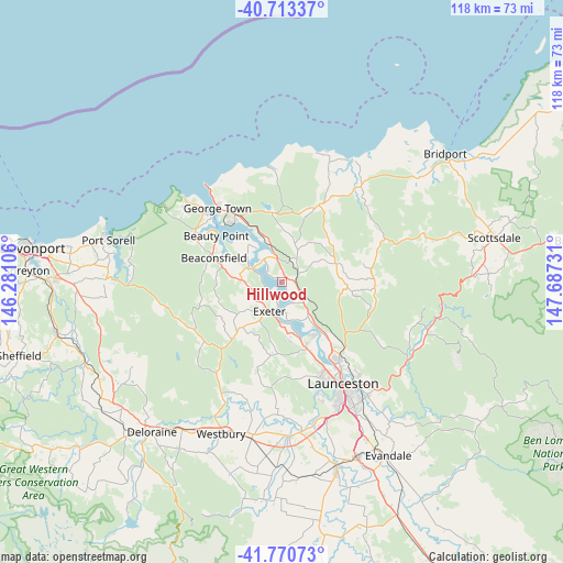
Hillwood GPS coordinates[2]
41° 14' 39.084" South, 146° 59' 3.048" East
| Map corner | latitude | longitude |
|---|---|---|
| Upper-left | -40.71337°, | 146.28106° |
| Center: | -41.24419°, | 146.98418° |
| Lower-right: | -41.77073°, | 147.68731° |
| Map W x H: | 117.6×117.6 km | = 73.1×73.1mi |
| max Lat: | -10.58257° ⇑97.1% North |
| Hillwood: | -41.24419° |
| min Lat: | ⇓2.9% South -43.31423° |
| min Long | Hillwood | max Long |
| 113.53327° | 146.98418° | 153.61246° |
| W 46.8%⇐ | ⇒53.2% E |
Elevation
Elevation of Hillwood is 48 m = 157 ft, and this is 74 m = 243 ft below average elevation for this country.
| Max E: |
1715 m = 5627 ft | 48% |
| Avg. | 122 m = 400 ft | |
| Hillwood | 48 m = 157 ft | |
Min E: |
-2 m = -7 ft | 52% |
See also: Australia elevation on elevation.city.
Geographical zone
Hillwood is located in South temperate zone (between Tropic of Capricorn and the Antarctic Circle). Distance of this Southern Tropic circle is 1980 km =1230.3 mi to North.| Distance of | km | miles | from Hillwood |
|---|---|---|---|
| Equator | 4585.9 | 2849.5 | to North |
| Tropic Capricorn | 1980 | 1230.3 | to North |
| Antarctic Circle | 2815.3 | 1749.3 | to South |
| South Pole | 5421.1 | 3368.5 | to South |


Nearby cities:
15 places around Hillwood: (largest is in red/bold)
• Beaconsfield
14.7 km =9.1 mi,  288°
288°
• Beauty Point
16.4 km =10.2 mi,  303°
303°
• Dilston
11.7 km =7.3 mi,  144°
144°
• Exeter
6.6 km =4.1 mi,  205°
205°
• George Town
20.3 km =12.6 mi,  319°
319°
• Gravelly Beach
4.7 km =2.9 mi,  189°
189°
• Grindelwald
12.1 km =7.5 mi,  171°
171°
• Invermay
23.2 km =14.4 mi,  147°
147°
• Legana
14.5 km =9 mi,  159°
159°
• Lilydale
19.5 km =12.1 mi,  91°
91°
• Mayfield
20.1 km =12.5 mi, 142°
• Mowbray
22.4 km =13.9 mi, 141°
• Newnham
19.5 km =12.1 mi, 146°
• Riverside
20.4 km =12.7 mi, 164°
• Rocherlea
21 km =13 mi, 136°
Sources, notices
• [Note1] Compared only with cities in Australia existing in our database
• [Src1] Map data: © OpenStreetMap contributors (CC-BY-SA)
• [Src2] Other city data from geonames.org with taken over terms of usage.
• [Src3] Geographical zone / Annual Mean Temperature by Robert A. Rohde @ Wikipedia
