Barooga geodata
Barooga (New South Wales) is a populated place; located in Australia in Australia/Sydney (GMT+11) time zone. With population of 1,811 people, there are 3041 cities with bigger population in this country. Compared to other cities in Australia, 78.1% of cities are located further ↑North; 58.7% of cities are located further →East and 72.9% of cities have lower elevation than Barooga. Note1


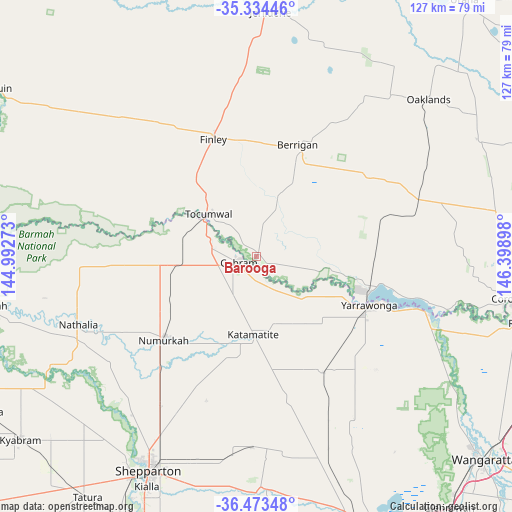
Barooga GPS coordinates[2]
35° 54' 21.672" South, 145° 41' 45.06" East
| Map corner | latitude | longitude |
|---|---|---|
| Upper-left | -35.33446°, | 144.99273° |
| Center: | -35.90602°, | 145.69585° |
| Lower-right: | -36.47348°, | 146.39898° |
| Map W x H: | 126.6×126.6 km | = 78.7×78.7mi |
| max Lat: | -10.58257° ⇑78.1% North |
| Barooga: | -35.90602° |
| min Lat: | ⇓21.9% South -43.31423° |
| min Long | Barooga | max Long |
| 113.53327° | 145.69585° | 153.61246° |
| W 41.3%⇐ | ⇒58.7% E |
Elevation
Elevation of Barooga is 117 m = 384 ft, and this is 5 m = 16 ft below average elevation for this country.
| Max E: |
1715 m = 5627 ft | 27.1% |
| Avg. | 122 m = 400 ft | |
| Barooga | 117 m = 384 ft | |
Min E: |
-2 m = -7 ft | 72.9% |
See also: Australia elevation on elevation.city.
Geographical zone
Barooga is located in South temperate zone (between Tropic of Capricorn and the Antarctic Circle). Distance of this Southern Tropic circle is 1386.5 km =861.5 mi to North.| Distance of | km | miles | from Barooga |
|---|---|---|---|
| Equator | 3992.4 | 2480.8 | to North |
| Tropic Capricorn | 1386.5 | 861.5 | to North |
| Antarctic Circle | 3408.8 | 2118.1 | to South |
| South Pole | 6014.7 | 3737.4 | to South |


Nearby cities:
15 places around Barooga: (largest is in red/bold)
• Berrigan
29.4 km =18.3 mi,  20°
20°
• Cobram
5.2 km =3.2 mi,  251°
251°
• Congupna
49.8 km =30.9 mi,  208°
208°
• Finley
30.1 km =18.7 mi,  338°
338°
• Grahamvale
54.4 km =33.8 mi, 205°
• Invergordon
30.7 km =19.1 mi,  199°
199°
• Katunga
23.6 km =14.7 mi,  239°
239°
• Mulwala
29.2 km =18.1 mi,  107°
107°
• Nathalia
47.4 km =29.5 mi, 249°
• Numurkah
30.5 km =19 mi,  228°
228°
• Strathmerton
19.7 km =12.2 mi,  263°
263°
• Tallygaroopna
44.9 km =27.9 mi, 211°
• Tocumwal
15.5 km =9.6 mi,  312°
312°
• Yarrawonga
30.1 km =18.7 mi, 114°
• Yarroweyah
12.6 km =7.8 mi, 260°
Sources, notices
• [Note1] Compared only with cities in Australia existing in our database
• [Src1] Map data: © OpenStreetMap contributors (CC-BY-SA)
• [Src2] Other city data from geonames.org with taken over terms of usage.
• [Src3] Geographical zone / Annual Mean Temperature by Robert A. Rohde @ Wikipedia
