Bamaga geodata
Bamaga (Queensland) is a populated place; located in Australia in Australia/Brisbane (GMT+10) time zone. With population of 1,237 people, there are 3530 cities with bigger population in this country. Compared to other cities in Australia, 99.9% of cities are located further ↓South; 74.4% of cities are located further →East and 58.4% of cities have higher elevation than Bamaga. Note1


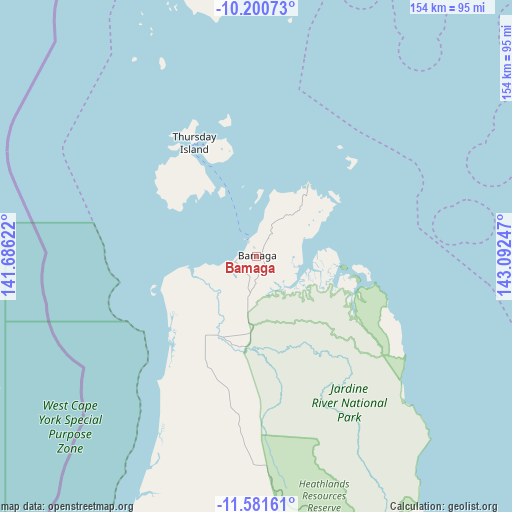
Bamaga GPS coordinates[2]
10° 53' 31.092" South, 142° 23' 21.624" East
| Map corner | latitude | longitude |
|---|---|---|
| Upper-left | -10.20073°, | 141.68622° |
| Center: | -10.89197°, | 142.38934° |
| Lower-right: | -11.58161°, | 143.09247° |
| Map W x H: | 153.5×153.5 km | = 95.4×95.4mi |
| max Lat: | -10.58257° ⇑0.1% North |
| Bamaga: | -10.89197° |
| min Lat: | ⇓99.9% South -43.31423° |
| min Long | Bamaga | max Long |
| 113.53327° | 142.38934° | 153.61246° |
| W 25.6%⇐ | ⇒74.4% E |
Elevation
Elevation of Bamaga is 34 m = 112 ft, and this is 88 m = 289 ft below average elevation for this country.
| Max E: |
1715 m = 5627 ft | 58.4% |
| Avg. | 122 m = 400 ft | |
| Bamaga | 34 m = 112 ft | |
Min E: |
-2 m = -7 ft | 41.6% |
See also: Australia elevation on elevation.city.
Geographical zone
Bamaga is located in South Torrid zone (between Equator and Tropic of Capricorn). Distance of Equator is 1211.1 km =752.5 mi to North.| Distance of | km | miles | from Bamaga |
|---|---|---|---|
| Equator | 1211.1 | 752.5 | to North |
| Tropic Capricorn | 1394.8 | 866.7 | to South |
| Antarctic Circle | 6190.1 | 3846.3 | to South |
| South Pole | 8796 | 5465.6 | to South |


Nearby cities:
10 places around Bamaga: (largest is in red/bold)
• Aurukun
283.3 km =176 mi,  194°
194°
• Horn
33.9 km =21.1 mi,  339°
339°
• Injinoo
23 km =14.3 mi,  217°
217°
• Lockhart River
234.9 km =146 mi,  153°
153°
• Mission River
195.1 km =121.2 mi, 193°
• Nanum
203.2 km =126.3 mi,  196°
196°
• New Mapoon
2.8 km =1.7 mi,  346°
346°
• Thursday Island
39.1 km =24.3 mi,  331°
331°
• Trunding
201.8 km =125.4 mi, 196°
• Weipa
200.4 km =124.5 mi, 196°
Sources, notices
• [Note1] Compared only with cities in Australia existing in our database
• [Src1] Map data: © OpenStreetMap contributors (CC-BY-SA)
• [Src2] Other city data from geonames.org with taken over terms of usage.
• [Src3] Geographical zone / Annual Mean Temperature by Robert A. Rohde @ Wikipedia
