New Mapoon geodata
New Mapoon (Queensland) is a populated place; located in Australia in Australia/Brisbane (GMT+10) time zone. With population of 573 people, there are 4640 cities with bigger population in this country. Compared to other cities in Australia, 100% of cities are located further ↓South; 74.4% of cities are located further →East and 53.1% of cities have higher elevation than New Mapoon. Note1


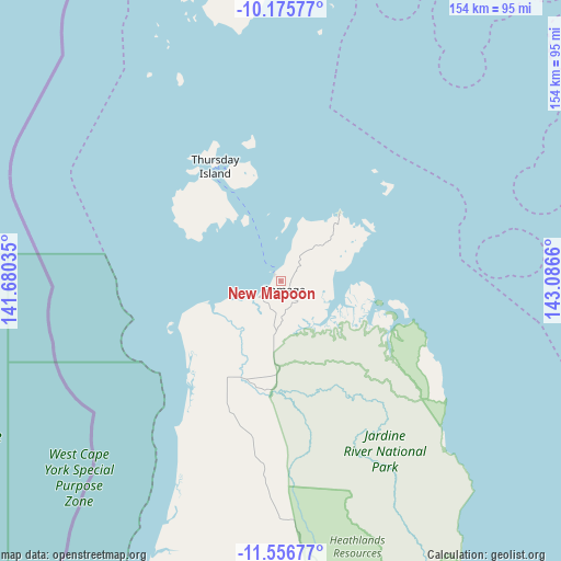
New Mapoon GPS coordinates[2]
10° 52' 1.452" South, 142° 23' 0.492" East
| Map corner | latitude | longitude |
|---|---|---|
| Upper-left | -10.17577°, | 141.68035° |
| Center: | -10.86707°, | 142.38347° |
| Lower-right: | -11.55677°, | 143.0866° |
| Map W x H: | 153.6×153.6 km | = 95.4×95.4mi |
| max Lat: | -10.58257° ⇑0% North |
| New Mapoon: | -10.86707° |
| min Lat: | ⇓100% South -43.31423° |
| min Long | New Mapoon | max Long |
| 113.53327° | 142.38347° | 153.61246° |
| W 25.6%⇐ | ⇒74.4% E |
Elevation
Elevation of New Mapoon is 41 m = 135 ft, and this is 81 m = 266 ft below average elevation for this country.
| Max E: |
1715 m = 5627 ft | 53.1% |
| Avg. | 122 m = 400 ft | |
| New Mapoon | 41 m = 135 ft | |
Min E: |
-2 m = -7 ft | 46.9% |
See also: Australia elevation on elevation.city.
Geographical zone
New Mapoon is located in South Torrid zone (between Equator and Tropic of Capricorn). Distance of Equator is 1208.3 km =750.8 mi to North.| Distance of | km | miles | from New Mapoon |
|---|---|---|---|
| Equator | 1208.3 | 750.8 | to North |
| Tropic Capricorn | 1397.6 | 868.4 | to South |
| Antarctic Circle | 6192.9 | 3848.1 | to South |
| South Pole | 8798.8 | 5467.3 | to South |


Nearby cities:
10 places around New Mapoon: (largest is in red/bold)
• Aurukun
285.8 km =177.6 mi,  194°
194°
• Bamaga
2.8 km =1.7 mi,  166°
166°
• Horn
31 km =19.3 mi,  338°
338°
• Injinoo
24.9 km =15.5 mi,  212°
212°
• Lockhart River
237.7 km =147.7 mi,  153°
153°
• Mission River
197.7 km =122.8 mi, 193°
• Nanum
205.7 km =127.8 mi,  196°
196°
• Thursday Island
36.4 km =22.6 mi,  330°
330°
• Trunding
204.3 km =126.9 mi, 195°
• Weipa
202.9 km =126.1 mi, 195°
Sources, notices
• [Note1] Compared only with cities in Australia existing in our database
• [Src1] Map data: © OpenStreetMap contributors (CC-BY-SA)
• [Src2] Other city data from geonames.org with taken over terms of usage.
• [Src3] Geographical zone / Annual Mean Temperature by Robert A. Rohde @ Wikipedia
