Weipa geodata
Weipa (Queensland) is a populated place; located in Australia in Australia/Brisbane (GMT+10) time zone. With population of 2,830 people, there are 2360 cities with bigger population in this country. Compared to other cities in Australia, 98.5% of cities are located further ↓South; 75% of cities are located further →East and 79% of cities have higher elevation than Weipa. Note1


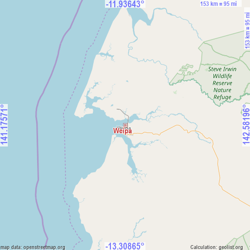
Weipa GPS coordinates[2]
12° 37' 24.456" South, 141° 52' 43.788" East
| Map corner | latitude | longitude |
|---|---|---|
| Upper-left | -11.93643°, | 141.17571° |
| Center: | -12.62346°, | 141.87883° |
| Lower-right: | -13.30865°, | 142.58196° |
| Map W x H: | 152.6×152.6 km | = 94.8×94.8mi |
| max Lat: | -10.58257° ⇑1.5% North |
| Weipa: | -12.62346° |
| min Lat: | ⇓98.5% South -43.31423° |
| min Long | Weipa | max Long |
| 113.53327° | 141.87883° | 153.61246° |
| W 25%⇐ | ⇒75% E |
Elevation
Elevation of Weipa is 16 m = 52 ft, and this is 106 m = 348 ft below average elevation for this country.
| Max E: |
1715 m = 5627 ft | 79% |
| Avg. | 122 m = 400 ft | |
| Weipa | 16 m = 52 ft | |
Min E: |
-2 m = -7 ft | 21% |
See also: Australia elevation on elevation.city.
Geographical zone
Weipa is located in South Torrid zone (between Equator and Tropic of Capricorn). Distance of this Southern Tropic circle is 1202.3 km =747.1 mi to South.| Distance of | km | miles | from Weipa |
|---|---|---|---|
| Equator | 1403.6 | 872.2 | to North |
| Tropic Capricorn | 1202.3 | 747.1 | to South |
| Antarctic Circle | 5997.6 | 3726.7 | to South |
| South Pole | 8603.5 | 5346 | to South |


Nearby cities:
13 places around Weipa: (largest is in red/bold)
• Aurukun
83.1 km =51.6 mi,  191°
191°
• Bamaga
200.4 km =124.5 mi,  16°
16°
• Horn
228.5 km =142 mi,  11°
11°
• Injinoo
179.2 km =111.3 mi, 13°
• Kowanyama
317.2 km =197.1 mi,  182°
182°
• Laura
408 km =253.5 mi,  142°
142°
• Lockhart River
159.9 km =99.4 mi,  96°
96°
• Mission River
9.1 km =5.7 mi,  69°
69°
• Nanum
3 km =1.9 mi,  216°
216°
• New Mapoon
202.9 km =126.1 mi, 15°
• Pormpuraaw
254.5 km =158.1 mi, 186°
• Thursday Island
229.9 km =142.9 mi, 9°
• Trunding
1.6 km =1 mi, 219°
Sources, notices
• [Note1] Compared only with cities in Australia existing in our database
• [Src1] Map data: © OpenStreetMap contributors (CC-BY-SA)
• [Src2] Other city data from geonames.org with taken over terms of usage.
• [Src3] Geographical zone / Annual Mean Temperature by Robert A. Rohde @ Wikipedia
