Injinoo geodata
Injinoo (Queensland) is a section of populated place; located in Australia in Australia/Brisbane (GMT+10) time zone. With population of 584 people, there are 4611 cities with bigger population in this country. Compared to other cities in Australia, 99.9% of cities are located further ↓South; 74.6% of cities are located further →East and 86.8% of cities have higher elevation than Injinoo. Note1


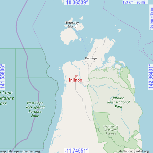
Injinoo GPS coordinates[2]
11° 3' 22.536" South, 142° 15' 40.248" East
| Map corner | latitude | longitude |
|---|---|---|
| Upper-left | -10.36539°, | 141.55806° |
| Center: | -11.05626°, | 142.26118° |
| Lower-right: | -11.74551°, | 142.96431° |
| Map W x H: | 153.5×153.5 km | = 95.4×95.4mi |
| max Lat: | -10.58257° ⇑0.1% North |
| Injinoo: | -11.05626° |
| min Lat: | ⇓99.9% South -43.31423° |
| min Long | Injinoo | max Long |
| 113.53327° | 142.26118° | 153.61246° |
| W 25.4%⇐ | ⇒74.6% E |
Elevation
Elevation of Injinoo is 11 m = 36 ft, and this is 111 m = 364 ft below average elevation for this country.
| Max E: |
1715 m = 5627 ft | 86.8% |
| Avg. | 122 m = 400 ft | |
| Injinoo | 11 m = 36 ft | |
Min E: |
-2 m = -7 ft | 13.2% |
See also: Australia elevation on elevation.city.
Geographical zone
Injinoo is located in South Torrid zone (between Equator and Tropic of Capricorn). Distance of Equator is 1229.3 km =763.9 mi to North.| Distance of | km | miles | from Injinoo |
|---|---|---|---|
| Equator | 1229.3 | 763.9 | to North |
| Tropic Capricorn | 1376.6 | 855.4 | to South |
| Antarctic Circle | 6171.8 | 3835 | to South |
| South Pole | 8777.7 | 5454.2 | to South |


Nearby cities:
11 places around Injinoo: (largest is in red/bold)
• Aurukun
262.2 km =162.9 mi,  192°
192°
• Bamaga
23 km =14.3 mi,  37°
37°
• Horn
50.1 km =31.1 mi,  2°
2°
• Lockhart River
225.6 km =140.2 mi,  148°
148°
• Mission River
174.3 km =108.3 mi, 190°
• Nanum
181.9 km =113 mi, 193°
• New Mapoon
24.9 km =15.5 mi,  32°
32°
• Pormpuraaw
432.8 km =268.9 mi, 189°
• Thursday Island
52.9 km =32.9 mi,  355°
355°
• Trunding
180.6 km =112.2 mi, 193°
• Weipa
179.2 km =111.3 mi, 193°
Sources, notices
• [Note1] Compared only with cities in Australia existing in our database
• [Src1] Map data: © OpenStreetMap contributors (CC-BY-SA)
• [Src2] Other city data from geonames.org with taken over terms of usage.
• [Src3] Geographical zone / Annual Mean Temperature by Robert A. Rohde @ Wikipedia
