Lockhart River geodata
Lockhart River (Queensland) is a populated place; located in Australia in Australia/Brisbane (GMT+10) time zone. With population of 761 people, there are 4223 cities with bigger population in this country. Compared to other cities in Australia, 98.4% of cities are located further ↓South; 73.8% of cities are located further →East and 61.1% of cities have higher elevation than Lockhart River. Note1


Lockhart River GPS coordinates[2]
12° 47' 14.028" South, 143° 20' 36.744" East
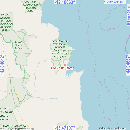
| Map corner | latitude | longitude |
|---|---|---|
| Upper-left | -12.10063°, | 142.64042° |
| Center: | -12.78723°, | 143.34354° |
| Lower-right: | -13.47197°, | 144.04667° |
| Map W x H: | 152.5×152.5 km | = 94.8×94.8mi |
| max Lat: | -10.58257° ⇑1.6% North |
| Lockhart River: | -12.78723° |
| min Lat: | ⇓98.4% South -43.31423° |
| min Long | Lockhart River | max Long |
| 113.53327° | 143.34354° | 153.61246° |
| W 26.2%⇐ | ⇒73.8% E |
Elevation
Elevation of Lockhart River is 31 m = 102 ft, and this is 91 m = 299 ft below average elevation for this country.
| Max E: |
1715 m = 5627 ft | 61.1% |
| Avg. | 122 m = 400 ft | |
| Lockhart River | 31 m = 102 ft | |
Min E: |
-2 m = -7 ft | 38.9% |
See also: Australia elevation on elevation.city.
Geographical zone
Lockhart River is located in South Torrid zone (between Equator and Tropic of Capricorn). Distance of this Southern Tropic circle is 1184.1 km =735.8 mi to South.| Distance of | km | miles | from Lockhart River |
|---|---|---|---|
| Equator | 1421.8 | 883.5 | to North |
| Tropic Capricorn | 1184.1 | 735.8 | to South |
| Antarctic Circle | 5979.4 | 3715.4 | to South |
| South Pole | 8585.3 | 5334.7 | to South |


Nearby cities:
15 places around Lockhart River: (largest is in red/bold)
• Aurukun
186.1 km =115.6 mi,  250°
250°
• Bamaga
234.9 km =146 mi,  333°
333°
• Cooktown
361.9 km =224.9 mi,  145°
145°
• Hope Vale
337.8 km =209.9 mi, 145°
• Horn
268.6 km =166.9 mi, 334°
• Injinoo
225.6 km =140.2 mi, 328°
• Kowanyama
344.8 km =214.2 mi,  209°
209°
• Laura
317.7 km =197.4 mi,  163°
163°
• Mission River
151.8 km =94.3 mi,  278°
278°
• Nanum
161.4 km =100.3 mi, 275°
• New Mapoon
237.7 km =147.7 mi, 333°
• Pormpuraaw
299.5 km =186.1 mi,  218°
218°
• Thursday Island
274 km =170.3 mi, 333°
• Trunding
160.8 km =99.9 mi, 276°
• Weipa
159.9 km =99.4 mi, 276°
Sources, notices
• [Note1] Compared only with cities in Australia existing in our database
• [Src1] Map data: © OpenStreetMap contributors (CC-BY-SA)
• [Src2] Other city data from geonames.org with taken over terms of usage.
• [Src3] Geographical zone / Annual Mean Temperature by Robert A. Rohde @ Wikipedia
