Glenden geodata
Glenden (Queensland) is a populated place; located in Australia in Australia/Brisbane (GMT+10) time zone. With population of 935 people, there are 3922 cities with bigger population in this country. Compared to other cities in Australia, 92.9% of cities are located further ↓South; 51.1% of cities are located further ←West and 89.8% of cities have lower elevation than Glenden. Note1


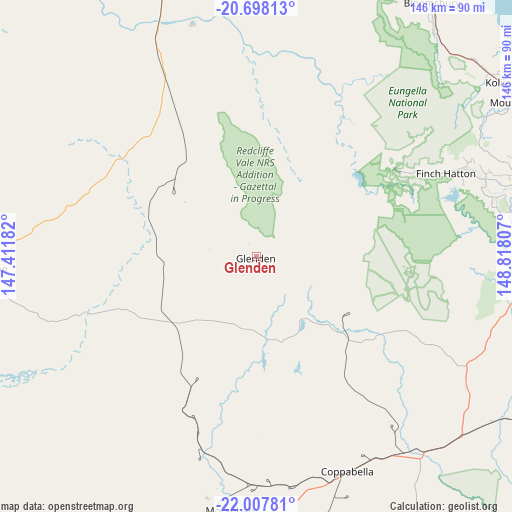
Glenden GPS coordinates[2]
21° 21' 15.948" South, 148° 6' 53.784" East
| Map corner | latitude | longitude |
|---|---|---|
| Upper-left | -20.69813°, | 147.41182° |
| Center: | -21.35443°, | 148.11494° |
| Lower-right: | -22.00781°, | 148.81807° |
| Map W x H: | 145.6×145.6 km | = 90.5×90.5mi |
| max Lat: | -10.58257° ⇑7.1% North |
| Glenden: | -21.35443° |
| min Lat: | ⇓92.9% South -43.31423° |
| min Long | Glenden | max Long |
| 113.53327° | 148.11494° | 153.61246° |
| W 51.1%⇐ | ⇒48.9% E |
Elevation
Elevation of Glenden is 364 m = 1194 ft, and this is 242 m = 794 ft above average elevation for this country.
| Max E: |
1715 m = 5627 ft | 10.2% |
| Glenden | 364 m 1194 ft | |
| Avg. | 122 m = 400 ft | |
Min E: |
-2 m = -7 ft | 89.8% |
See also: Australia elevation on elevation.city.
Geographical zone
Glenden is located in South Torrid zone (between Equator and Tropic of Capricorn). Distance of this Southern Tropic circle is 231.5 km =143.8 mi to South.| Distance of | km | miles | from Glenden |
|---|---|---|---|
| Equator | 2374.4 | 1475.4 | to North |
| Tropic Capricorn | 231.5 | 143.8 | to South |
| Antarctic Circle | 5026.8 | 3123.5 | to South |
| South Pole | 7632.7 | 4742.7 | to South |


Nearby cities:
15 places around Glenden: (largest is in red/bold)
• Bloomsbury
87 km =54.1 mi,  35°
35°
• Collinsville
93.5 km =58.1 mi,  342°
342°
• Coppabella
68.6 km =42.6 mi,  163°
163°
• Eton
89.4 km =55.6 mi,  83°
83°
• Finch Hatton
58.3 km =36.2 mi,  65°
65°
• Hail Creek
39.2 km =24.4 mi,  127°
127°
• Hampden
90.7 km =56.4 mi, 69°
• Kuttabul
88.9 km =55.2 mi, 66°
• Marian
88.9 km =55.2 mi, 74°
• Mirani
80.5 km =50 mi, 74°
• Moranbah
72.3 km =44.9 mi,  185°
185°
• Nebo
69.2 km =43 mi,  121°
121°
• Seaforth
101.9 km =63.3 mi,  60°
60°
• The Leap
98.2 km =61 mi, 72°
• Walkerston
100.1 km =62.2 mi, 77°
Sources, notices
• [Note1] Compared only with cities in Australia existing in our database
• [Src1] Map data: © OpenStreetMap contributors (CC-BY-SA)
• [Src2] Other city data from geonames.org with taken over terms of usage.
• [Src3] Geographical zone / Annual Mean Temperature by Robert A. Rohde @ Wikipedia
