East Warburton geodata
East Warburton (Victoria) is a section of populated place; located in Australia in Australia/Melbourne (GMT+11) time zone. With population of 852 people, there are 4058 cities with bigger population in this country. Compared to other cities in Australia, 85.7% of cities are located further ↑North; 58.2% of cities are located further →East and 83.6% of cities have lower elevation than East Warburton. Note1


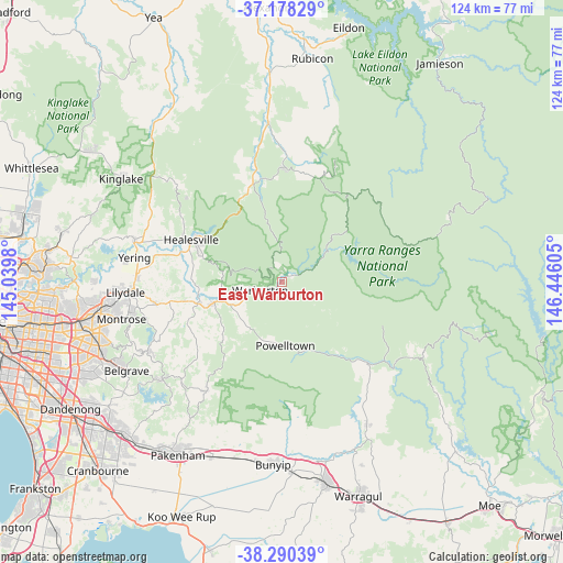
East Warburton GPS coordinates[2]
37° 44' 11.148" South, 145° 44' 34.512" East
| Map corner | latitude | longitude |
|---|---|---|
| Upper-left | -37.17829°, | 145.0398° |
| Center: | -37.73643°, | 145.74292° |
| Lower-right: | -38.29039°, | 146.44605° |
| Map W x H: | 123.7×123.7 km | = 76.9×76.9mi |
| max Lat: | -10.58257° ⇑85.7% North |
| East Warburton: | -37.73643° |
| min Lat: | ⇓14.3% South -43.31423° |
| min Long | East Warburton | max Long |
| 113.53327° | 145.74292° | 153.61246° |
| W 41.8%⇐ | ⇒58.2% E |
Elevation
Elevation of East Warburton is 225 m = 738 ft, and this is 103 m = 338 ft above average elevation for this country.
| Max E: |
1715 m = 5627 ft | 16.4% |
| East Warburton | 225 m 738 ft | |
| Avg. | 122 m = 400 ft | |
Min E: |
-2 m = -7 ft | 83.6% |
See also: Australia elevation on elevation.city.
Geographical zone
East Warburton is located in South temperate zone (between Tropic of Capricorn and the Antarctic Circle). Distance of this Southern Tropic circle is 1590 km =988 mi to North.| Distance of | km | miles | from East Warburton |
|---|---|---|---|
| Equator | 4195.9 | 2607.2 | to North |
| Tropic Capricorn | 1590 | 988 | to North |
| Antarctic Circle | 3205.3 | 1991.7 | to South |
| South Pole | 5811.2 | 3610.9 | to South |


Nearby cities:
15 places around East Warburton: (largest is in red/bold)
• Badger Creek
20.3 km =12.6 mi,  281°
281°
• Chum Creek
26.8 km =16.7 mi,  302°
302°
• Don Valley
13.2 km =8.2 mi,  270°
270°
• Gruyere
25.8 km =16 mi, 270°
• Healesville
21.9 km =13.6 mi,  294°
294°
• Hoddles Creek
17.7 km =11 mi,  232°
232°
• Launching Place
16.1 km =10 mi,  252°
252°
• Millgrove
8.1 km =5 mi,  255°
255°
• Seville
23.5 km =14.6 mi, 253°
• Seville East
22 km =13.7 mi, 258°
• Warburton
5 km =3.1 mi, 247°
• Wesburn
10.2 km =6.3 mi, 250°
• Woori Yallock
18.7 km =11.6 mi, 254°
• Yarra Junction
12.4 km =7.7 mi, 245°
• Yellingbo
22.4 km =13.9 mi,  237°
237°
Sources, notices
• [Note1] Compared only with cities in Australia existing in our database
• [Src1] Map data: © OpenStreetMap contributors (CC-BY-SA)
• [Src2] Other city data from geonames.org with taken over terms of usage.
• [Src3] Geographical zone / Annual Mean Temperature by Robert A. Rohde @ Wikipedia
