Kizhaba geodata
Kizhaba (Astara) is a populated place; located in Azerbaijan in Asia/Baku (GMT+4) time zone. With population of 4,567 people, there are 111 cities with bigger population in this country. Compared to other cities in Azerbaijan, 99.5% of cities are located further ↑North; 67% of cities are located further ←West and 70.8% of cities have higher elevation than Kizhaba. Note1


Kizhaba GPS coordinates[2]
38° 32' 4.596" North, 48° 48' 19.656" East
| Map corner | latitude | longitude |
|---|---|---|
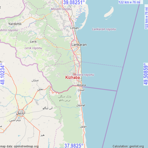
| Upper-left | 39.08251°, | 48.10234° |
| Center: | 38.53461°, | 48.80546° |
| Lower-right: | 37.9825°, | 49.50859° |
| Map W x H: | 122.3×122.3 km | = 76×76mi |
| max Lat: | 41.75259° ⇑99.5% North |
| Kizhaba: | 38.53461° |
| min Lat: | ⇓0.5% South 38.45598° |
| min Long | Kizhaba | max Long |
| 44.84846° | 48.80546° | 50.84003° |
| W 67%⇐ | ⇒33% E |
Elevation
Elevation of Kizhaba is 24 m = 79 ft, and this is 359 m = 1178 ft below average elevation for this country.
| Max E: |
2211 m = 7254 ft | 70.8% |
| Avg. | 383 m = 1257 ft | |
| Kizhaba | 24 m = 79 ft | |
Min E: |
-26 m = -85 ft | 29.2% |
See also: Azerbaijan elevation on elevation.city.
Geographical zone
Kizhaba is located in North temperate zone (between Tropic of Cancer and the Arctic Circle). Distance of this Northern Tropic circle is 1678.7 km =1043.1 mi to South.| Distance of | km | miles | from Kizhaba |
|---|---|---|---|
| North Pole | 5722.4 | 3555.7 | to North |
| Arctic Circle | 3116.5 | 1936.5 | to North |
| Tropic Cancer | 1678.7 | 1043.1 | to South |
| Equator | 4284.6 | 2662.3 | to South |


Nearby cities:
15 places around Kizhaba: (largest is in red/bold)
• Astara
10.6 km =6.6 mi,  145°
145°
• Boradigah
44.8 km =27.8 mi,  349°
349°
• Haftoni
25.7 km =16 mi, 351°
• Jalilabad
79.8 km =49.6 mi,  340°
340°
• Lankaran
24.7 km =15.3 mi,  9°
9°
• Lerik
43.1 km =26.8 mi,  308°
308°
• Masally
57 km =35.4 mi, 347°
• Neftçala
101.1 km =62.8 mi,  22°
22°
• Prishibinskoye
67.6 km =42 mi, 344°
• Pushkino
105.1 km =65.3 mi, 347°
• Salyan
119 km =73.9 mi, 7°
• Severo-Vostotchnyi Bank
104.7 km =65.1 mi, 21°
• Sovetabad
95.9 km =59.6 mi, 21°
• Xıllı
102.8 km =63.9 mi, 14°
• Yardımlı
64.2 km =39.9 mi, 310°
Sources, notices
• [Note1] Compared only with cities in Azerbaijan existing in our database
• [Src1] Map data: © OpenStreetMap contributors (CC-BY-SA)
• [Src2] Other city data from geonames.org with taken over terms of usage.
• [Src3] Geographical zone / Annual Mean Temperature by Robert A. Rohde @ Wikipedia
