Severo-Vostotchnyi Bank geodata
Severo-Vostotchnyi Bank (Neftçala) is a populated place; located in Azerbaijan in Asia/Baku (GMT+4) time zone. With population of 7,075 people, there are 94 cities with bigger population in this country. Compared to other cities in Azerbaijan, 84.9% of cities are located further ↑North; 76.8% of cities are located further ←West and 99.5% of cities have higher elevation than Severo-Vostotchnyi Bank. Note1
Current local time in Severo-Vostotchnyi Bank:
12:32 PM, TuesdayDifference from your time zone: hours


Severo-Vostotchnyi Bank GPS coordinates[2]
39° 24' 40.212" North, 49° 14' 52.512" East
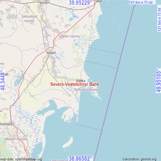
| Map corner | latitude | longitude |
|---|---|---|
| Upper-left | 39.95229°, | 48.5448° |
| Center: | 39.41117°, | 49.24792° |
| Lower-right: | 38.86582°, | 49.95105° |
| Map W x H: | 120.8×120.8 km | = 75.1×75.1mi |
| max Lat: | 41.75259° ⇑84.9% North |
| Severo-Vostotchnyi Bank: | 39.41117° |
| min Lat: | ⇓15.1% South 38.45598° |
| min Long | Severo-Vostotch | max Long |
| 44.84846° | 49.24792° | 50.84003° |
| W 76.8%⇐ | ⇒23.2% E |
Elevation
Elevation of Severo-Vostotchnyi Bank is -25 m = -82 ft, and this is 408 m = 1339 ft below average elevation for this country.
| Max E: |
2211 m = 7254 ft | 99.5% |
| Avg. | 383 m = 1257 ft | |
| Severo-Vostotchnyi Bank | -25 m = -82 ft | |
Min E: |
-26 m = -85 ft | 0.5% |
See also: Azerbaijan elevation on elevation.city.
Geographical zone
Severo-Vostotchnyi Bank is located in North temperate zone (between Tropic of Cancer and the Arctic Circle). Distance of this Northern Tropic circle is 1776.2 km =1103.7 mi to South.| Distance of | km | miles | from Severo-Vostotchnyi Bank |
|---|---|---|---|
| North Pole | 5625 | 3495.2 | to North |
| Arctic Circle | 3019.1 | 1876 | to North |
| Tropic Cancer | 1776.2 | 1103.7 | to South |
| Equator | 4382.1 | 2722.9 | to South |


Nearby cities:
15 places around Severo-Vostotchnyi Bank: (largest is in red/bold)
• Boradigah
70.8 km =44 mi,  220°
220°
• Hacıqabul
74.5 km =46.3 mi,  339°
339°
• Haftoni
83.3 km =51.8 mi,  210°
210°
• Jalilabad
68.8 km =42.8 mi,  250°
250°
• Lankaran
80.7 km =50.1 mi, 205°
• Masally
65.3 km =40.6 mi,  230°
230°
• Neftçala
3.8 km =2.4 mi,  181°
181°
• Prishibinskoye
65 km =40.4 mi,  240°
240°
• Pushkino
60.6 km =37.7 mi,  274°
274°
• Qaraçala
52.3 km =32.5 mi,  329°
329°
• Qobustan
75.9 km =47.2 mi,  10°
10°
• Salyan
30.5 km =19 mi,  312°
312°
• Sovetabad
8.8 km =5.5 mi,  199°
199°
• Xıllı
12.7 km =7.9 mi,  279°
279°
• Şirvan
64.6 km =40.1 mi, 335°
Sources, notices
• [Note1] Compared only with cities in Azerbaijan existing in our database
• [Src1] Map data: © OpenStreetMap contributors (CC-BY-SA)
• [Src2] Other city data from geonames.org with taken over terms of usage.
• [Src3] Geographical zone / Annual Mean Temperature by Robert A. Rohde @ Wikipedia
