Saloğlu geodata
Saloğlu (Ağstafa) is a populated place; located in Azerbaijan in Asia/Baku (GMT+4) time zone. With population of 1,581 people, there are 161 cities with bigger population in this country. Compared to other cities in Azerbaijan, 90.3% of cities are located further ↓South; 96.8% of cities are located further →East and 52.4% of cities have lower elevation than Saloğlu. Note1


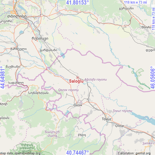
Saloğlu GPS coordinates[2]
41° 16' 30.864" North, 45° 21' 10.548" East
| Map corner | latitude | longitude |
|---|---|---|
| Upper-left | 41.80153°, | 44.64981° |
| Center: | 41.27524°, | 45.35293° |
| Lower-right: | 40.74467°, | 46.05606° |
| Map W x H: | 117.5×117.5 km | = 73×73mi |
| max Lat: | 41.75259° ⇑9.7% North |
| Saloğlu: | 41.27524° |
| min Lat: | ⇓90.3% South 38.45598° |
| min Long | Saloğlu | max Long |
| 44.84846° | 45.35293° | 50.84003° |
| W 3.2%⇐ | ⇒96.8% E |
Elevation
Elevation of Saloğlu is 249 m = 817 ft, and this is 134 m = 440 ft below average elevation for this country.
| Max E: |
2211 m = 7254 ft | 47.6% |
| Avg. | 383 m = 1257 ft | |
| Saloğlu | 249 m = 817 ft | |
Min E: |
-26 m = -85 ft | 52.4% |
See also: Azerbaijan elevation on elevation.city.
Geographical zone
Saloğlu is located in North temperate zone (between Tropic of Cancer and the Arctic Circle). Distance of this Northern Tropic circle is 1983.5 km =1232.5 mi to South.| Distance of | km | miles | from Saloğlu |
|---|---|---|---|
| North Pole | 5417.7 | 3366.4 | to North |
| Arctic Circle | 2811.8 | 1747.2 | to North |
| Tropic Cancer | 1983.5 | 1232.5 | to South |
| Equator | 4589.4 | 2851.7 | to South |


Nearby cities:
15 places around Saloğlu: (largest is in red/bold)
• Aghstafa
19.3 km =12 mi,  154°
154°
• Arıqdam
84.6 km =52.6 mi, 153°
• Böyük Qaramurad
81.3 km =50.5 mi,  162°
162°
• Dolyar
73.3 km =45.5 mi,  128°
128°
• Dondar Quşçu
42.1 km =26.2 mi, 148°
• Dzagam
60.9 km =37.8 mi, 132°
• Novosaratovka
78.1 km =48.5 mi, 164°
• Qaraxanlı
36.1 km =22.4 mi,  135°
135°
• Qazax
20.4 km =12.7 mi,  177°
177°
• Shamkhor
74.6 km =46.4 mi, 131°
• Tovuz
39 km =24.2 mi, 143°
• Vurğun
22.3 km =13.9 mi, 153°
• Yanıqlı
55.3 km =34.4 mi, 150°
• Çatax
63.5 km =39.5 mi, 164°
• Çobansığnaq
65.3 km =40.6 mi, 152°
Sources, notices
• [Note1] Compared only with cities in Azerbaijan existing in our database
• [Src1] Map data: © OpenStreetMap contributors (CC-BY-SA)
• [Src2] Other city data from geonames.org with taken over terms of usage.
• [Src3] Geographical zone / Annual Mean Temperature by Robert A. Rohde @ Wikipedia
