Vurğun geodata
Vurğun (Ağstafa) is a populated place; located in Azerbaijan in Asia/Baku (GMT+4) time zone. With population of 2,635 people, there are 134 cities with bigger population in this country. Compared to other cities in Azerbaijan, 87.6% of cities are located further ↓South; 93.5% of cities are located further →East and 60.5% of cities have lower elevation than Vurğun. Note1


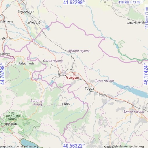
Vurğun GPS coordinates[2]
41° 5' 42.864" North, 45° 28' 15.996" East
| Map corner | latitude | longitude |
|---|---|---|
| Upper-left | 41.62299°, | 44.76799° |
| Center: | 41.09524°, | 45.47111° |
| Lower-right: | 40.56322°, | 46.17424° |
| Map W x H: | 117.8×117.8 km | = 73.2×73.2mi |
| max Lat: | 41.75259° ⇑12.4% North |
| Vurğun: | 41.09524° |
| min Lat: | ⇓87.6% South 38.45598° |
| min Long | Vurğun | max Long |
| 44.84846° | 45.47111° | 50.84003° |
| W 6.5%⇐ | ⇒93.5% E |
Elevation
Elevation of Vurğun is 356 m = 1168 ft, and this is 27 m = 89 ft below average elevation for this country.
| Max E: |
2211 m = 7254 ft | 39.5% |
| Avg. | 383 m = 1257 ft | |
| Vurğun | 356 m = 1168 ft | |
Min E: |
-26 m = -85 ft | 60.5% |
See also: Azerbaijan elevation on elevation.city.
Geographical zone
Vurğun is located in North temperate zone (between Tropic of Cancer and the Arctic Circle). Distance of this Northern Tropic circle is 1963.4 km =1220 mi to South.| Distance of | km | miles | from Vurğun |
|---|---|---|---|
| North Pole | 5437.7 | 3378.8 | to North |
| Arctic Circle | 2831.8 | 1759.6 | to North |
| Tropic Cancer | 1963.4 | 1220 | to South |
| Equator | 4569.4 | 2839.3 | to South |


Nearby cities:
15 places around Vurğun: (largest is in red/bold)
• Aghstafa
3 km =1.9 mi,  331°
331°
• Arıqdam
62.3 km =38.7 mi,  153°
153°
• Böyük Qaramurad
59.4 km =36.9 mi,  166°
166°
• Dolyar
53.9 km =33.5 mi,  118°
118°
• Dondar Quşçu
20 km =12.4 mi,  141°
141°
• Dzagam
40.8 km =25.4 mi, 121°
• Novosaratovka
56.3 km =35 mi, 168°
• Qaraxanlı
16.5 km =10.3 mi,  110°
110°
• Qazax
8.8 km =5.5 mi,  267°
267°
• Saloğlu
22.3 km =13.9 mi, 333°
• Shamkhor
54.6 km =33.9 mi, 122°
• Tovuz
17.4 km =10.8 mi,  130°
130°
• Yanıqlı
33.1 km =20.6 mi, 147°
• Çatax
41.7 km =25.9 mi, 169°
• Çobansığnaq
42.9 km =26.7 mi, 152°
Sources, notices
• [Note1] Compared only with cities in Azerbaijan existing in our database
• [Src1] Map data: © OpenStreetMap contributors (CC-BY-SA)
• [Src2] Other city data from geonames.org with taken over terms of usage.
• [Src3] Geographical zone / Annual Mean Temperature by Robert A. Rohde @ Wikipedia
