Böyük Qaramurad geodata
Böyük Qaramurad (Gǝdǝbǝy) is a populated place; located in Azerbaijan in Asia/Baku (GMT+4) time zone. With population of 2,684 people, there are 132 cities with bigger population in this country. Compared to other cities in Azerbaijan, 65.9% of cities are located further ↓South; 89.2% of cities are located further →East and 91.9% of cities have lower elevation than Böyük Qaramurad. Note1


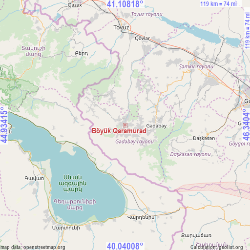
Böyük Qaramurad GPS coordinates[2]
40° 34' 34.536" North, 45° 38' 14.172" East
| Map corner | latitude | longitude |
|---|---|---|
| Upper-left | 41.10818°, | 44.93415° |
| Center: | 40.57626°, | 45.63727° |
| Lower-right: | 40.04008°, | 46.3404° |
| Map W x H: | 118.8×118.8 km | = 73.8×73.8mi |
| max Lat: | 41.75259° ⇑34.1% North |
| Böyük Qaramurad: | 40.57626° |
| min Lat: | ⇓65.9% South 38.45598° |
| min Long | Böyük Qaramur | max Long |
| 44.84846° | 45.63727° | 50.84003° |
| W 10.8%⇐ | ⇒89.2% E |
Elevation
Elevation of Böyük Qaramurad is 1202 m = 3944 ft, and this is 819 m = 2687 ft above average elevation for this country.
| Max E: |
2211 m = 7254 ft | 8.1% |
| Böyük Qaramurad | 1202 m 3944 ft | |
| Avg. | 383 m = 1257 ft | |
Min E: |
-26 m = -85 ft | 91.9% |
See also: Azerbaijan elevation on elevation.city.
Geographical zone
Böyük Qaramurad is located in North temperate zone (between Tropic of Cancer and the Arctic Circle). Distance of this Northern Tropic circle is 1905.7 km =1184.1 mi to South.| Distance of | km | miles | from Böyük Qaramurad |
|---|---|---|---|
| North Pole | 5495.4 | 3414.7 | to North |
| Arctic Circle | 2889.5 | 1795.5 | to North |
| Tropic Cancer | 1905.7 | 1184.1 | to South |
| Equator | 4511.7 | 2803.4 | to South |


Nearby cities:
15 places around Böyük Qaramurad: (largest is in red/bold)
• Alunitdağ
35.4 km =22 mi,  98°
98°
• Arıqdam
13.8 km =8.6 mi,  82°
82°
• Arıqıran
4.5 km =2.8 mi,  205°
205°
• Dolyar
46.2 km =28.7 mi,  46°
46°
• Dondar Quşçu
42 km =26.1 mi,  357°
357°
• Dzagam
42 km =26.1 mi,  29°
29°
• Kyadabek
14.8 km =9.2 mi,  92°
92°
• Novosaratovka
3.9 km =2.4 mi,  308°
308°
• Shamkhor
42.7 km =26.5 mi, 48°
• Tovuz
46.3 km =28.8 mi, 359°
• Verkhniy Dashkesan
37.8 km =23.5 mi, 104°
• Yanıqlı
29.9 km =18.6 mi,  6°
6°
• Yukhary-Dashkesan
38 km =23.6 mi, 98°
• Çatax
17.9 km =11.1 mi,  338°
338°
• Çobansığnaq
20.4 km =12.7 mi,  16°
16°
Sources, notices
• [Note1] Compared only with cities in Azerbaijan existing in our database
• [Src1] Map data: © OpenStreetMap contributors (CC-BY-SA)
• [Src2] Other city data from geonames.org with taken over terms of usage.
• [Src3] Geographical zone / Annual Mean Temperature by Robert A. Rohde @ Wikipedia
