Nardaran geodata
Nardaran (Baki) is a populated place; located in Azerbaijan in Asia/Baku (GMT+4) time zone. With population of 7,700 people, there are 87 cities with bigger population in this country. Compared to other cities in Azerbaijan, 63.2% of cities are located further ↓South; 93% of cities are located further ←West and 67.6% of cities have higher elevation than Nardaran. Note1


Nardaran GPS coordinates[2]
40° 33' 21.996" North, 50° 0' 20.016" East
| Map corner | latitude | longitude |
|---|---|---|
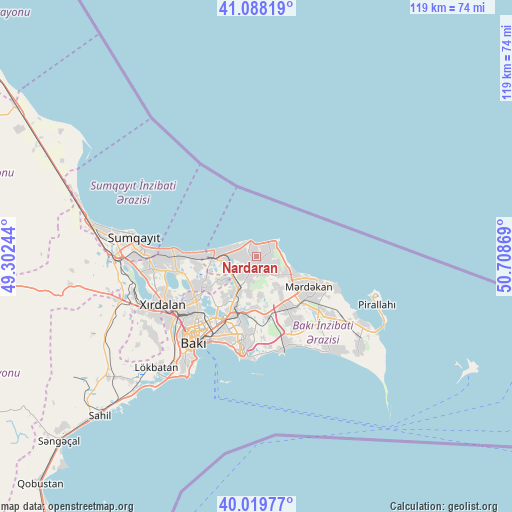
| Upper-left | 41.08819°, | 49.30244° |
| Center: | 40.55611°, | 50.00556° |
| Lower-right: | 40.01977°, | 50.70869° |
| Map W x H: | 118.8×118.8 km | = 73.8×73.8mi |
| max Lat: | 41.75259° ⇑36.8% North |
| Nardaran: | 40.55611° |
| min Lat: | ⇓63.2% South 38.45598° |
| min Long | Nardaran | max Long |
| 44.84846° | 50.00556° | 50.84003° |
| W 93%⇐ | ⇒7% E |
Elevation
Elevation of Nardaran is 28 m = 92 ft, and this is 355 m = 1165 ft below average elevation for this country.
| Max E: |
2211 m = 7254 ft | 67.6% |
| Avg. | 383 m = 1257 ft | |
| Nardaran | 28 m = 92 ft | |
Min E: |
-26 m = -85 ft | 32.4% |
See also: Azerbaijan elevation on elevation.city.
Geographical zone
Nardaran is located in North temperate zone (between Tropic of Cancer and the Arctic Circle). Distance of this Northern Tropic circle is 1903.5 km =1182.8 mi to South.| Distance of | km | miles | from Nardaran |
|---|---|---|---|
| North Pole | 5497.6 | 3416 | to North |
| Arctic Circle | 2891.8 | 1796.9 | to North |
| Tropic Cancer | 1903.5 | 1182.8 | to South |
| Equator | 4509.4 | 2802 | to South |


Nearby cities:
15 places around Nardaran: (largest is in red/bold)
• Amirdzhan
14.5 km =9 mi,  187°
187°
• Bakıxanov
15.6 km =9.7 mi, 192°
• Balakhani
12.6 km =7.8 mi,  215°
215°
• Bilajer
3.1 km =1.9 mi,  72°
72°
• Binagadi
18.1 km =11.2 mi,  236°
236°
• Biny Selo
13.6 km =8.5 mi,  149°
149°
• Buzovna
10.1 km =6.3 mi,  114°
114°
• Digah
13.1 km =8.1 mi, 237°
• Mardakan
13.6 km =8.5 mi,  121°
121°
• Maştağa
2.9 km =1.8 mi,  179°
179°
• Qaraçuxur
17.9 km =11.1 mi, 188°
• Ramana
12.8 km =8 mi, 189°
• Sabunçu
13.5 km =8.4 mi,  201°
201°
• Yeni Suraxanı
14.2 km =8.8 mi,  169°
169°
• Zabrat
10.3 km =6.4 mi,  211°
211°
Sources, notices
• [Note1] Compared only with cities in Azerbaijan existing in our database
• [Src1] Map data: © OpenStreetMap contributors (CC-BY-SA)
• [Src2] Other city data from geonames.org with taken over terms of usage.
• [Src3] Geographical zone / Annual Mean Temperature by Robert A. Rohde @ Wikipedia
