Verkhniy Dashkesan geodata
Verkhniy Dashkesan (Daşkǝsǝn) is a populated place; located in Azerbaijan in Asia/Baku (GMT+4) time zone. With population of 1,837 people, there are 151 cities with bigger population in this country. Compared to other cities in Azerbaijan, 56.8% of cities are located further ↓South; 79.5% of cities are located further →East and 97.8% of cities have lower elevation than Verkhniy Dashkesan. Note1


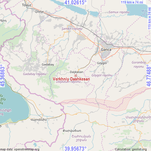
Verkhniy Dashkesan GPS coordinates[2]
40° 29' 36.852" North, 46° 4' 18.3" East
| Map corner | latitude | longitude |
|---|---|---|
| Upper-left | 41.02615°, | 45.36863° |
| Center: | 40.49357°, | 46.07175° |
| Lower-right: | 39.95673°, | 46.77488° |
| Map W x H: | 118.9×118.9 km | = 73.9×73.9mi |
| max Lat: | 41.75259° ⇑43.2% North |
| Verkhniy Dashkesan: | 40.49357° |
| min Lat: | ⇓56.8% South 38.45598° |
| min Long | Verkhniy Dashke | max Long |
| 44.84846° | 46.07175° | 50.84003° |
| W 20.5%⇐ | ⇒79.5% E |
Elevation
Elevation of Verkhniy Dashkesan is 1592 m = 5223 ft, and this is 1209 m = 3967 ft above average elevation for this country.
| Max E: |
2211 m = 7254 ft | 2.2% |
| Verkhniy Dashkesan | 1592 m 5223 ft | |
| Avg. | 383 m = 1257 ft | |
Min E: |
-26 m = -85 ft | 97.8% |
See also: Azerbaijan elevation on elevation.city.
Geographical zone
Verkhniy Dashkesan is located in North temperate zone (between Tropic of Cancer and the Arctic Circle). Distance of this Northern Tropic circle is 1896.5 km =1178.4 mi to South.| Distance of | km | miles | from Verkhniy Dashkesan |
|---|---|---|---|
| North Pole | 5504.6 | 3420.4 | to North |
| Arctic Circle | 2898.7 | 1801.2 | to North |
| Tropic Cancer | 1896.5 | 1178.4 | to South |
| Equator | 4502.5 | 2797.7 | to South |


Nearby cities:
15 places around Verkhniy Dashkesan: (largest is in red/bold)
• Alunitdağ
4.3 km =2.7 mi,  337°
337°
• Arıqdam
25.6 km =15.9 mi,  295°
295°
• Arıqıran
39 km =24.2 mi,  277°
277°
• Böyük Qaramurad
37.8 km =23.5 mi, 284°
• Dolyar
41.2 km =25.6 mi,  355°
355°
• Ganja
32.2 km =20 mi,  49°
49°
• Kyadabek
23.5 km =14.6 mi,  291°
291°
• Novosaratovka
41.5 km =25.8 mi, 286°
• Qarayeri
38.5 km =23.9 mi,  32°
32°
• Qasım İsmayılov
38.8 km =24.1 mi,  24°
24°
• Samux
41.5 km =25.8 mi,  43°
43°
• Shamkhor
37.7 km =23.4 mi,  353°
353°
• Yelenendorf
23.3 km =14.5 mi,  63°
63°
• Yukhary-Dashkesan
3.5 km =2.2 mi,  14°
14°
• Çobansığnaq
42.2 km =26.2 mi,  313°
313°
Sources, notices
• [Note1] Compared only with cities in Azerbaijan existing in our database
• [Src1] Map data: © OpenStreetMap contributors (CC-BY-SA)
• [Src2] Other city data from geonames.org with taken over terms of usage.
• [Src3] Geographical zone / Annual Mean Temperature by Robert A. Rohde @ Wikipedia
