Alunitdağ geodata
Alunitdağ (Daşkǝsǝn) is a populated place; located in Azerbaijan in Asia/Baku (GMT+4) time zone. With population of 857 people, there are 178 cities with bigger population in this country. Compared to other cities in Azerbaijan, 60% of cities are located further ↓South; 80% of cities are located further →East and 99.5% of cities have lower elevation than Alunitdağ. Note1


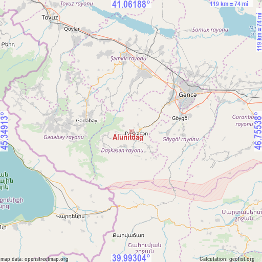
Alunitdağ GPS coordinates[2]
40° 31' 46.524" North, 46° 3' 8.1" East
| Map corner | latitude | longitude |
|---|---|---|
| Upper-left | 41.06188°, | 45.34913° |
| Center: | 40.52959°, | 46.05225° |
| Lower-right: | 39.99304°, | 46.75538° |
| Map W x H: | 118.8×118.8 km | = 73.8×73.8mi |
| max Lat: | 41.75259° ⇑40% North |
| Alunitdağ: | 40.52959° |
| min Lat: | ⇓60% South 38.45598° |
| min Long | Alunitdağ | max Long |
| 44.84846° | 46.05225° | 50.84003° |
| W 20%⇐ | ⇒80% E |
Elevation
Elevation of Alunitdağ is 1653 m = 5423 ft, and this is 1270 m = 4167 ft above average elevation for this country.
| Max E: |
2211 m = 7254 ft | 0.5% |
| Alunitdağ | 1653 m 5423 ft | |
| Avg. | 383 m = 1257 ft | |
Min E: |
-26 m = -85 ft | 99.5% |
See also: Azerbaijan elevation on elevation.city.
Geographical zone
Alunitdağ is located in North temperate zone (between Tropic of Cancer and the Arctic Circle). Distance of this Northern Tropic circle is 1900.5 km =1180.9 mi to South.| Distance of | km | miles | from Alunitdağ |
|---|---|---|---|
| North Pole | 5500.6 | 3417.9 | to North |
| Arctic Circle | 2894.7 | 1798.7 | to North |
| Tropic Cancer | 1900.5 | 1180.9 | to South |
| Equator | 4506.5 | 2800.2 | to South |


Nearby cities:
15 places around Alunitdağ: (largest is in red/bold)
• Arıqdam
22.5 km =14 mi,  288°
288°
• Arıqıran
37 km =23 mi,  271°
271°
• Böyük Qaramurad
35.4 km =22 mi,  278°
278°
• Dolyar
37.1 km =23.1 mi,  357°
357°
• Ganja
31.1 km =19.3 mi,  56°
56°
• Kyadabek
20.8 km =12.9 mi, 282°
• Novosaratovka
38.9 km =24.2 mi, 281°
• Qarayeri
36.1 km =22.4 mi,  37°
37°
• Qasım İsmayılov
36 km =22.4 mi,  29°
29°
• Samux
39.9 km =24.8 mi,  48°
48°
• Shamkhor
33.5 km =20.8 mi, 355°
• Verkhniy Dashkesan
4.3 km =2.7 mi,  157°
157°
• Yelenendorf
23.4 km =14.5 mi,  74°
74°
• Yukhary-Dashkesan
2.6 km =1.6 mi,  104°
104°
• Çobansığnaq
38.3 km =23.8 mi,  310°
310°
Sources, notices
• [Note1] Compared only with cities in Azerbaijan existing in our database
• [Src1] Map data: © OpenStreetMap contributors (CC-BY-SA)
• [Src2] Other city data from geonames.org with taken over terms of usage.
• [Src3] Geographical zone / Annual Mean Temperature by Robert A. Rohde @ Wikipedia
