Bhairab Bāzār geodata
Bhairab Bāzār (Dhaka) is a populated place; located in Bangladesh in Asia/Dhaka (GMT+6) time zone. With population of 105,457 people, there are 34 cities with bigger population in this country. Compared to other cities in Bangladesh, 59.8% of cities are located further ↓South; 82.1% of cities are located further ←West and 70.1% of cities have higher elevation than Bhairab Bāzār. Note1
Administrative division(s):
- Level 1: Dhaka
- Level 2: Kishoregonj
- Level 3: Bhairab Upazila
- Level 4: Paurashava


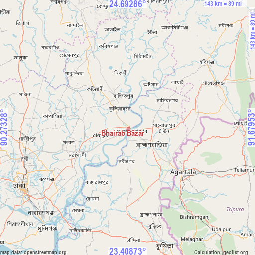
Bhairab Bāzār GPS coordinates[2]
24° 3' 8.64" North, 90° 58' 35.04" East
| Map corner | latitude | longitude |
|---|---|---|
| Upper-left | 24.69286°, | 90.27328° |
| Center: | 24.0524°, | 90.9764° |
| Lower-right: | 23.40873°, | 91.67953° |
| Map W x H: | 142.8×142.8 km | = 88.7×88.7mi |
| max Lat: | 26.33338° ⇑40.2% North |
| Bhairab Bāzār: | 24.0524° |
| min Lat: | ⇓59.8% South 20.85829° |
| min Long | Bhairab Bāzār | max Long |
| 88.15638° | 90.9764° | 92.29773° |
| W 82.1%⇐ | ⇒17.9% E |
Elevation
Elevation of Bhairab Bāzār is 12 m = 39 ft, and this is 5.9 m = 19 ft below average elevation for this country.
| Max E: |
79 m = 259 ft | 70.1% |
| Avg. | 17.9 m = 59 ft | |
| Bhairab Bāzār | 12 m = 39 ft | |
Min E: |
2 m = 7 ft | 29.9% |
See also: Bhairab Bāzār elevation on elevation.city.
Geographical zone
Bhairab Bāzār is located in North temperate zone (between Tropic of Cancer and the Arctic Circle). Distance of this Northern Tropic circle is 68.5 km =42.6 mi to South.| Distance of | km | miles | from Bhairab Bāzār |
|---|---|---|---|
| North Pole | 7332.7 | 4556.3 | to North |
| Arctic Circle | 4726.8 | 2937.1 | to North |
| Tropic Cancer | 68.5 | 42.6 | to South |
| Equator | 2674.4 | 1661.8 | to South |


Nearby cities:
15 places around Bhairab Bāzār: (largest is in red/bold)
• Azimpur
70 km =43.5 mi,  239°
239°
• Baniachang
64.7 km =40.2 mi,  36°
36°
• Bājitpur
18.4 km =11.4 mi,  351°
351°
• Comilla
69 km =42.9 mi,  162°
162°
• Dhaka
69.2 km =43 mi, 236°
• Gafargaon
59.8 km =37.2 mi,  314°
314°
• Habiganj
57.4 km =35.7 mi,  50°
50°
• Khanbaniara
86 km =53.4 mi,  249°
249°
• Kishorganj
47.3 km =29.4 mi,  335°
335°
• Nabīnagar
18.3 km =11.4 mi,  182°
182°
• Narsingdi
30 km =18.6 mi, 241°
• Nārāyanganj
68.6 km =42.6 mi,  224°
224°
• Paltan
67.1 km =41.7 mi, 238°
• Sonārgaon
57.8 km =35.9 mi, 219°
• Tungi
61 km =37.9 mi, 252°
Sources, notices
• [Note1] Compared only with cities in Bangladesh existing in our database
• [Src1] Map data: © OpenStreetMap contributors (CC-BY-SA)
• [Src2] Other city data from geonames.org with taken over terms of usage.
• [Src3] Geographical zone / Annual Mean Temperature by Robert A. Rohde @ Wikipedia
