Somme-Leuze geodata
Somme-Leuze (Wallonia) is a populated place; located in Belgium in Europe/Brussels (GMT+2) time zone. With population of 4,532 people, there are 468 cities with bigger population in this country. Compared to other cities in Belgium, 87.7% of cities are located further ↑North; 79.6% of cities are located further ←West and 81.9% of cities have lower elevation than Somme-Leuze. Note1
Administrative division(s):
- Level 1: Wallonia
- Level 2: Province de Namur
- Level 3: Arrondissement de Dinant
- Level 4: Somme-Leuze


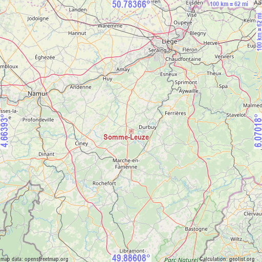
Somme-Leuze GPS coordinates[2]
50° 20' 13.164" North, 5° 22' 1.38" East
| Map corner | latitude | longitude |
|---|---|---|
| Upper-left | 50.78366°, | 4.66393° |
| Center: | 50.33699°, | 5.36705° |
| Lower-right: | 49.88608°, | 6.07018° |
| Map W x H: | 99.8×99.8 km | = 62×62mi |
| max Lat: | 51.46791° ⇑87.7% North |
| Somme-Leuze: | 50.33699° |
| min Lat: | ⇓12.3% South 49.53771° |
| min Long | Somme-Leuze | max Long |
| 2.59368° | 5.36705° | 6.25749° |
| W 79.6%⇐ | ⇒20.4% E |
Elevation
Elevation of Somme-Leuze is 191 m = 627 ft, and this is 91.5 m = 300 ft above average elevation for this country.
| Max E: |
582 m = 1909 ft | 18.1% |
| Somme-Leuze | 191 m 627 ft | |
| Avg. | 99.5 m = 326 ft | |
Min E: |
1 m = 3 ft | 81.9% |
See also: Belgium elevation on elevation.city.
Geographical zone
Somme-Leuze is located in North temperate zone (between Tropic of Cancer and the Arctic Circle). Distance of this North polar circle is 1804.2 km =1121.1 mi to North.| Distance of | km | miles | from Somme-Leuze |
|---|---|---|---|
| North Pole | 4410.1 | 2740.3 | to North |
| Arctic Circle | 1804.2 | 1121.1 | to North |
| Tropic Cancer | 2991 | 1858.5 | to South |
| Equator | 5596.9 | 3477.8 | to South |


Nearby cities:
15 places around Somme-Leuze: (largest is in red/bold)
• Clavier
7.2 km =4.5 mi,  351°
351°
• Durbuy
6.6 km =4.1 mi,  74°
74°
• Ferrières
18.7 km =11.6 mi, 67°
• Hamoir
15.4 km =9.6 mi,  49°
49°
• Hamois
15 km =9.3 mi,  271°
271°
• Havelange
10.8 km =6.7 mi,  302°
302°
• Hotton
9.6 km =6 mi,  144°
144°
• Marche-en-Famenne
12.4 km =7.7 mi,  187°
187°
• Marchin
16.9 km =10.5 mi,  328°
328°
• Modave
13.2 km =8.2 mi,  337°
337°
• Nandrin
19.2 km =11.9 mi,  11°
11°
• Ouffet
13.3 km =8.3 mi,  31°
31°
• Rendeux
15 km =9.3 mi, 139°
• Tinlot
15.4 km =9.6 mi,  2°
2°
• Érezée
14.4 km =8.9 mi,  109°
109°
Sources, notices
• [Note1] Compared only with cities in Belgium existing in our database
• [Src1] Map data: © OpenStreetMap contributors (CC-BY-SA)
• [Src2] Other city data from geonames.org with taken over terms of usage.
• [Src3] Geographical zone / Annual Mean Temperature by Robert A. Rohde @ Wikipedia
