Tinlot geodata
Tinlot (Wallonia) is a populated place; located in Belgium in Europe/Brussels (GMT+2) time zone. With population of 2,236 people, there are 531 cities with bigger population in this country. Compared to other cities in Belgium, 78.2% of cities are located further ↑North; 80.3% of cities are located further ←West and 90.8% of cities have lower elevation than Tinlot. Note1
Administrative division(s):
- Level 1: Wallonia
- Level 2: Province de Liège
- Level 3: Arrondissement de Huy
- Level 4: Tinlot


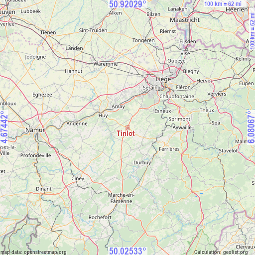
Tinlot GPS coordinates[2]
50° 28' 29.748" North, 5° 22' 39.18" East
| Map corner | latitude | longitude |
|---|---|---|
| Upper-left | 50.92029°, | 4.67442° |
| Center: | 50.47493°, | 5.37755° |
| Lower-right: | 50.02533°, | 6.08067° |
| Map W x H: | 99.5×99.5 km | = 61.8×61.8mi |
| max Lat: | 51.46791° ⇑78.2% North |
| Tinlot: | 50.47493° |
| min Lat: | ⇓21.8% South 49.53771° |
| min Long | Tinlot | max Long |
| 2.59368° | 5.37755° | 6.25749° |
| W 80.3%⇐ | ⇒19.7% E |
Elevation
Elevation of Tinlot is 271 m = 889 ft, and this is 171.5 m = 563 ft above average elevation for this country.
| Max E: |
582 m = 1909 ft | 9.2% |
| Tinlot | 271 m 889 ft | |
| Avg. | 99.5 m = 326 ft | |
Min E: |
1 m = 3 ft | 90.8% |
See also: Belgium elevation on elevation.city.
Geographical zone
Tinlot is located in North temperate zone (between Tropic of Cancer and the Arctic Circle). Distance of this North polar circle is 1788.9 km =1111.6 mi to North.| Distance of | km | miles | from Tinlot |
|---|---|---|---|
| North Pole | 4394.8 | 2730.8 | to North |
| Arctic Circle | 1788.9 | 1111.6 | to North |
| Tropic Cancer | 3006.4 | 1868.1 | to South |
| Equator | 5612.3 | 3487.3 | to South |


Nearby cities:
15 places around Tinlot: (largest is in red/bold)
• Amay
9.5 km =5.9 mi,  329°
329°
• Anthisnes
10.1 km =6.3 mi,  84°
84°
• Clavier
8.5 km =5.3 mi,  192°
192°
• Comblain-au-Pont
14.1 km =8.8 mi,  90°
90°
• Engis
12 km =7.5 mi,  7°
7°
• Flémalle-Haute
14.7 km =9.1 mi,  18°
18°
• Hamoir
12.2 km =7.6 mi,  115°
115°
• Havelange
13.7 km =8.5 mi,  226°
226°
• Huy
11.3 km =7 mi,  295°
295°
• Marchin
9.6 km =6 mi,  264°
264°
• Modave
6.6 km =4.1 mi,  241°
241°
• Nandrin
4.6 km =2.9 mi,  39°
39°
• Ouffet
7.4 km =4.6 mi, 122°
• Villers-le-Bouillet
14.1 km =8.8 mi,  323°
323°
• Wanze
13.9 km =8.6 mi, 300°
Sources, notices
• [Note1] Compared only with cities in Belgium existing in our database
• [Src1] Map data: © OpenStreetMap contributors (CC-BY-SA)
• [Src2] Other city data from geonames.org with taken over terms of usage.
• [Src3] Geographical zone / Annual Mean Temperature by Robert A. Rohde @ Wikipedia
