Rochefort geodata
Rochefort (Wallonia) is a populated place; located in Belgium in Europe/Brussels (GMT+2) time zone. With population of 11,978 people, there are 246 cities with bigger population in this country. Compared to other cities in Belgium, 92.4% of cities are located further ↑North; 73.8% of cities are located further ←West and 78.9% of cities have lower elevation than Rochefort. Note1
Administrative division(s):
- Level 1: Wallonia
- Level 2: Province de Namur
- Level 3: Arrondissement de Dinant
- Level 4: Rochefort


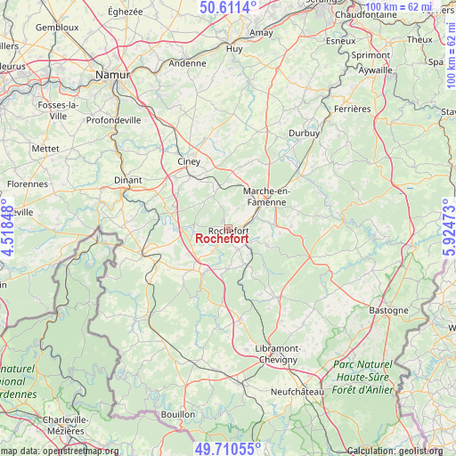
Rochefort GPS coordinates[2]
50° 9' 47.16" North, 5° 13' 17.76" East
| Map corner | latitude | longitude |
|---|---|---|
| Upper-left | 50.6114°, | 4.51848° |
| Center: | 50.1631°, | 5.2216° |
| Lower-right: | 49.71055°, | 5.92473° |
| Map W x H: | 100.2×100.2 km | = 62.3×62.3mi |
| max Lat: | 51.46791° ⇑92.4% North |
| Rochefort: | 50.1631° |
| min Lat: | ⇓7.6% South 49.53771° |
| min Long | Rochefort | max Long |
| 2.59368° | 5.2216° | 6.25749° |
| W 73.8%⇐ | ⇒26.2% E |
Elevation
Elevation of Rochefort is 170 m = 558 ft, and this is 70.5 m = 231 ft above average elevation for this country.
| Max E: |
582 m = 1909 ft | 21.1% |
| Rochefort | 170 m 558 ft | |
| Avg. | 99.5 m = 326 ft | |
Min E: |
1 m = 3 ft | 78.9% |
See also: Belgium elevation on elevation.city.
Geographical zone
Rochefort is located in North temperate zone (between Tropic of Cancer and the Arctic Circle). Distance of this North polar circle is 1823.6 km =1133.1 mi to North.| Distance of | km | miles | from Rochefort |
|---|---|---|---|
| North Pole | 4429.4 | 2752.3 | to North |
| Arctic Circle | 1823.6 | 1133.1 | to North |
| Tropic Cancer | 2971.7 | 1846.5 | to South |
| Equator | 5577.6 | 3465.8 | to South |


Nearby cities:
15 places around Rochefort: (largest is in red/bold)
• Beauraing
19.8 km =12.3 mi,  252°
252°
• Ciney
17 km =10.6 mi,  329°
329°
• Daverdisse
17.4 km =10.8 mi,  205°
205°
• Hamois
20.2 km =12.6 mi,  346°
346°
• Hotton
19.7 km =12.2 mi,  54°
54°
• Houyet
15.5 km =9.6 mi,  279°
279°
• Libin
20.4 km =12.7 mi,  173°
173°
• Marche-en-Famenne
11.2 km =7 mi, 50°
• Nassogne
9.5 km =5.9 mi,  114°
114°
• Rendeux
21.6 km =13.4 mi,  68°
68°
• Saint-Hubert
18.7 km =11.6 mi,  144°
144°
• Somme-Leuze
21.9 km =13.6 mi,  28°
28°
• Tellin
9.2 km =5.7 mi,  182°
182°
• Tenneville
23.2 km =14.4 mi, 109°
• Wellin
11.9 km =7.4 mi,  220°
220°
Sources, notices
• [Note1] Compared only with cities in Belgium existing in our database
• [Src1] Map data: © OpenStreetMap contributors (CC-BY-SA)
• [Src2] Other city data from geonames.org with taken over terms of usage.
• [Src3] Geographical zone / Annual Mean Temperature by Robert A. Rohde @ Wikipedia
