Rebecq-Rognon geodata
Rebecq-Rognon (Wallonia) is a populated place; located in Belgium in Europe/Brussels (GMT+2) time zone. With population of 10,049 people, there are 302 cities with bigger population in this country. Compared to other cities in Belgium, 63.7% of cities are located further ↑North; 71.8% of cities are located further →East and 56.5% of cities have lower elevation than Rebecq-Rognon. Note1
Administrative division(s):
- Level 1: Wallonia
- Level 2: Province du Brabant Wallon
- Level 3: Arrondissement de Nivelles
- Level 4: Rebecq


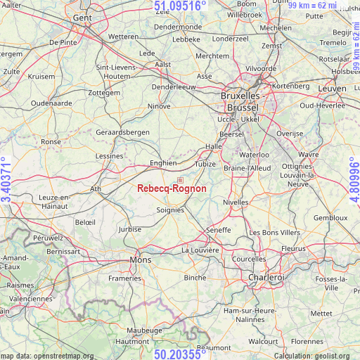
Rebecq-Rognon GPS coordinates[2]
50° 39' 5.292" North, 4° 6' 24.588" East
| Map corner | latitude | longitude |
|---|---|---|
| Upper-left | 51.09516°, | 3.40371° |
| Center: | 50.65147°, | 4.10683° |
| Lower-right: | 50.20355°, | 4.80996° |
| Map W x H: | 99.1×99.1 km | = 61.6×61.6mi |
| max Lat: | 51.46791° ⇑63.7% North |
| Rebecq-Rognon: | 50.65147° |
| min Lat: | ⇓36.3% South 49.53771° |
| min Long | Rebecq-Rognon | max Long |
| 2.59368° | 4.10683° | 6.25749° |
| W 28.2%⇐ | ⇒71.8% E |
Elevation
Elevation of Rebecq-Rognon is 65 m = 213 ft, and this is 34.5 m = 113 ft below average elevation for this country.
| Max E: |
582 m = 1909 ft | 43.5% |
| Avg. | 99.5 m = 326 ft | |
| Rebecq-Rognon | 65 m = 213 ft | |
Min E: |
1 m = 3 ft | 56.5% |
See also: Belgium elevation on elevation.city.
Geographical zone
Rebecq-Rognon is located in North temperate zone (between Tropic of Cancer and the Arctic Circle). Distance of this North polar circle is 1769.3 km =1099.4 mi to North.| Distance of | km | miles | from Rebecq-Rognon |
|---|---|---|---|
| North Pole | 4375.1 | 2718.6 | to North |
| Arctic Circle | 1769.3 | 1099.4 | to North |
| Tropic Cancer | 3026 | 1880.3 | to South |
| Equator | 5631.9 | 3499.5 | to South |


Nearby cities:
15 places around Rebecq-Rognon: (largest is in red/bold)
• Braine-le-Château
12.2 km =7.6 mi,  74°
74°
• Braine-le-Comte
5.4 km =3.4 mi,  148°
148°
• Enghien
6.3 km =3.9 mi,  304°
304°
• Galmaarden
14.9 km =9.3 mi,  320°
320°
• Gooik
15.9 km =9.9 mi,  1°
1°
• Halle
12.8 km =8 mi,  44°
44°
• Herne
9.5 km =5.9 mi,  327°
327°
• Ittre
11.2 km =7 mi,  94°
94°
• Nivelles
16.7 km =10.4 mi,  110°
110°
• Pepingen
12.5 km =7.8 mi,  17°
17°
• Roeulx
16.4 km =10.2 mi,  178°
178°
• Silly
12.9 km =8 mi,  268°
268°
• Soignies
8.4 km =5.2 mi,  197°
197°
• Tubize
7.9 km =4.9 mi,  56°
56°
• Écaussinnes-d’Enghien
10.1 km =6.3 mi,  155°
155°
Sources, notices
• [Note1] Compared only with cities in Belgium existing in our database
• [Src1] Map data: © OpenStreetMap contributors (CC-BY-SA)
• [Src2] Other city data from geonames.org with taken over terms of usage.
• [Src3] Geographical zone / Annual Mean Temperature by Robert A. Rohde @ Wikipedia
